Lomonosov Ridge off Greenland (LOMROG) 2007: Danish Continental Shelf Project
12 August 2007 - 17 September 2007
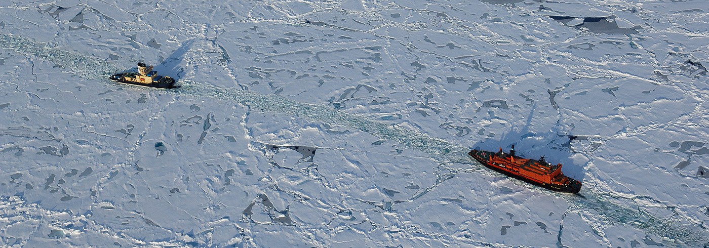
Left: 50 let Pobedy under way alongside Oden to break the ice.
Right: 50 let Pobedy reversing to “pick up” Oden. These operations occurred often during seismic data acquisition due to the severe ice conditions in the area of investigation. Photos: Thomas Vangkilde-Pedersen.
Introduction and background
The area north of Greenland is one of three potential areas off Greenland for extension of the continental shelf beyond 200 nautical miles according to the United Nations Convention on the Law of the Sea (UNCLOS), article 76 (Marcussen et al. 2004). The technical data needed for a submission to the Commission on the Limits of the Continental Shelf (CLCS) include geodetic, bathymetric, geophysical and geological data. Acquisition of the necessary data poses substantial logistical problems due to the ice conditions in the area north of Greenland.

Seismic equipment used during the LOMROG cruise. Photos: Thomas Vangkilde-Pedersen.
As the Danish part of the LOMROG expedition was the first Danish ship borne activity in the Arctic Ocean ever, one of the main goals of the expedition was to test the data acquisition concepts and especially the new reflection seismic equipment on board Oden under severe ice conditions (10/10 of several meters thick multi-year sea ice under compression). It was furthermore planned to acquire as much bathymetric data as possible to support the delineation of the foot of the continental slope, to map the sediment thickness in the Amundsen Basin and to investigate the bathymetric trough between the Lomonosov Ridge and the Canada/Greenland shelf. The Canadian Continental Shelf project participated with a small bathymetric programme planned in Canadian waters. Finally, acquisition of gravity data was planned to support the mapping of the sediment thickness.
The Danish Continental Shelf Project funded half of the costs for Oden and the full costs for the Russian nuclear icebreaker 50 let Pobedy.
Seismic data acquisition
The seismic reflection equipment used during the LOMROG cruise has been developed in cooperation with the Department of Earth Science, University of Aarhus, and is based on the experience gained by various people who have acquired reflection seismic data in the Arctic Ocean from icebreakers since 1991 (especially Yngve Kristoffersen, Art Grantz and Wilfried Jokat). The crucial issue of seismic data acquisition in ice covered waters is to protect the seismic equipment from being damaged by sea ice while simultaneously acquiring useful data in this very noisy environment. It was therefore decided to tow both airgun and streamer at a suitable depth (approximately 20 meters below water surface), to ensure that the equipment would stay clear from the propeller wash behind the ship. However, at such a large source depth the surface ghost reflections will cause undesirable notches in the source spectrum at 30 Hz and 60 Hz. The seismic equipment is fully containerized and consists of a winch container with three winches, a compressor container, a recording container and a storage container. A heavy duty umbilical both feeds the airguns with compressed air and connects with the seismic streamer. For smooth launch and retrieval of the equipment the winches and Oden’s A-frame were used. Acquisition parameters are summarized in Table 1.

Due to the short length of the seismic streamer, velocity information from the sedimentary units is very limited. However, sediment velocities are important for the documentation of the sediment thickness of the extended continental shelf, if the 1%- sediment-thickness formula (Gardiner line) has to be applied. Therefore, sonobuoys were deployed along the seismic lines to record the seismic signals at larger offsets.
On-board processing (using ProMax software) concentrated on the evaluation of data quality, noise reduction and acquisition parameters. It showed that the noise level after processing is acceptable considering the conditions under which the data were acquired. Analysis of subsets of the seismic data indicated that a streamer with four sections instead of six sections would provide record sections with only slightly reduced data quality.
Seismic data acquisition started in the Amundsen Basin, where an approximately 130 km long profile was acquired over the course of two days. A brute stack section from onboard data processing is shown in picture 1. At the southern part of the Lomonosov Ridge area only 15 km of seismic data were acquired due to severe ice conditions. The most vulnerable part of the seismic equipment is the streamer and due to the ice conditions parts of the streamer were lost on two occasions. Finally a 165 km long seismic line supplemented by seven sonobuoys was acquired in the area where the East Greenland Ridge abuts on the North East Greenland shelf.

Launching of the seismic equipment: Airgun cluster lower left and umbilical head above the two participants. Photo: Trine Dahl-Jensen.

Part of seismic line acquired in the Amundsen Basin (water depth approximately 4 000 m).
Bathymetric data acquisition
During LOMROG, bathymetric data were recorded continuously along the ship’s passage. The areas of specific bathymetric interest to the Danish Continental Shelf Project were:
- the Amundsen Basin,
- the slope of the Lomonosov Ridge, where the exact location of the foot of the continental slope was identified,
- the crest of the Lomonosov Ridge, where the general outline of the Lomonosov Ridge was mapped and verified,
- the zone where the Greenland shelf and the Lomonosov Ridge connect, for which very few bathymetric data exist,
- the Morris Jesup Rise, where the precise location of the foot of the slope was mapped,
- and finally, the East Greenland Ridge, where a high-resolution full-coverage multibeam survey was carried out in order to reveal the morphological features of the shelf-ridge complex.
Data quality was very dependent on the ice conditions. At the Lomonosov Ridge, where the ice thickness was up to 4 m with abundant pressure ridges, it was impossible to acquire data during ice-breaking and hence, alternative hydrographical surveying methods had to be employed (e.g. the “pirouette method”). These methods are, however, more time consuming.
The East Greenland Ridge survey area was partly in open water and partly covered by polar drift ice. The data coverage was almost 100% in all areas including the outer shelf, the slope, the abyssal plain and the central part of the East Greenland Ridge. Five lines extending from the upper shelf break and across the ridge were surveyed with the multibeam echo sounder. figure 2 shows a bathymetric map that was compiled from portions of two of the surveyed multibeam lines. The multibeam data from the East Greenland Ridge reveal important details of significant value for the interpretation of the area and for planning of additional work.

Top: Part of the bathymetric grid in the East Greenland Ridge area based on two of the surveyed multibeam lines.
Bottom: Bathymetric profile – units in meters.
Gravimetric data acquisition
Gravity measurements were carried out with a marine gravimeter of type Ultrasys Lacoste and Romberg (Serial no. S-38). The gravimeter was mounted in the engine room close to the centre of mass of Oden (picture 4). The system records data every 10 sec, which after processing and reference measurements in the harbours of Tromsø and Svalbard yield gravity values at an accuracy of approximately 1 mgal and 2–500 m resolution, depending on the speed of Oden and ice conditions.

Marine gravimeter mounted in the engine room on board Oden. Photo: Rene Forsberg
As a complement to the marine gravity data, the ship’s helicopter was used to make measurements with land gravimeters along profiles across the flanks of the Lomonosov Ridge and the Morris Jesup Rise (figure 3).
Gravimeter data collected on Oden were processed using the DNSC marine software “eotvos”, that incorporates Eötvös corrections from the ship’s GPS navigation (logged at 5 s intervals), outlier and spike detection, and a zero-phase filtering scheme. Some minor data gaps occurred for a short period of time due to some serial communications problems. However, most gaps were sufficiently short (a few minutes) to allow interpolation.

Location of the off-ship helicopter gravity profiles. Greenland at lower left.
Oden provided an excellent platform for marine gravity measurements, and measurements in the ice were superior to data from many other icebreakers or even submarines, in spite of the irregular navigation with frequent course and speed changes. The Ultrasys Lacoste Romberg gravimeter employed proved stable and reliable with only a small drift and the gravimetric data collected will be useful both in connection with the Danish UNCLOS project, as well as an important new data contribution to the Arctic Gravity Project.
The helicopter measurements were swift and efficient, but limited by the range of the helicopter and by the weather (frequent whiteout conditions). However, with a functioning echo sounder and an increased operation range, this could be an efficient way to collect relevant additional geophysical data on future cruises.
Other activities
A research project with the aim of investigating and quantifying the importance of sea ice in transporting carbon dioxide from the atmosphere to the ocean in areas with different types of sea ice has been associated with the Danish part of the LOMROG cruise (see Rysgaard et al. for details). Furthermore a Danish film crew (Suvi Helminen and Kenneth Sorento) from STV Nature and Science was stationed on board Oden during the LOMROG cruise to document the project and the cruise.

Seismic equipment used during the LOMROG cruise. Photos: Thomas Vangkilde-Pedersen
Conclusion
The LOMROG cruise demonstrated that acquisition of bathymetric and seismic data of sufficient quality for substantiating a claim according to article 76 of UNCLOS by a two ship operation is possible under the severe ice conditions that prevail in the area north of Greenland, and data acquisition would not have been feasible without the competent support from the Russian nuclear icebreaker 50 let Pobedy.