Glacial and environmental history of Severnaya Zemlya, Siberian High Arctic, during the last >130 000 years
1 July 2002 - 29 August 2002
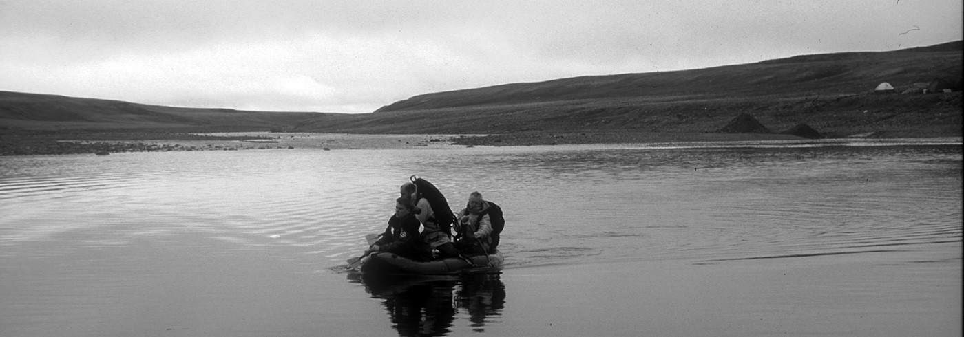
Glaciotectonically disturbed sediments of marine unit 2, below till-2 at site 29. Ice movement from left-to-right. Photo: Ólafur Ingólfsson
Introduction
The extent, volume and timing of past glaciations in the Eurasian Arctic remain disputed, despite substantial research efforts for the past few years (reviews in Svendsen et al., 1999 and Forman et al., 2002). Reconstructions of ice extent during the Last Glacial Maximum (approximately 20 ka (kilo-years) before present (BP)), have ranged from a minimum model, recognizing small ice caps restricted to the arctic archipelagos, to a maximum model, reconstructing a pan-arctic, >2 000 m thick ice sheet covering the Barents Sea, the Kara Sea and western Siberia. The reconstructions differ in volume by approx. 14 m of global sea level, equivalent to more than two present Greenland ice sheets. Research during the past few years has led to reconstructions that are not consistent with any of these models, but which demonstrate that a substantially larger ice sheet existed in the Barents Sea than in the Kara Sea during the Last Glacial Maximum (Forman et al., 1999, 2002 and Svendsen et al., 1999). However, large uncertainties have remained, especially regarding the potential presence of an ice sheet in the northern Kara Sea and adjacent land areas, particularly in the Severnaya Zemlya archipelago.
Previous investigations on the Kara Sea ice sheet
Research over the past decade in the Pechora Basin, west of the Polar Urals, places the last glacial advance from the Kara Sea prior to the Last Glacial Maximum (Mangerud et al., 2001) probably some time around 60 ka BP. Thus the southern limit of the Last Glacial Maximum Barents Sea-Kara Sea ice sheet was somewhere north of the present coastline of northern Russia. Our previous work on western Yamal Peninsula constrains the eastern limit of the Kara Sea ice at the Last Glacial Maximum (Ingólfsson, 1998 and Forman et al., 1999, 2002): A well-dated stratigraphy shows that the last glacial advance occurred before approximately 45 ka BP, and that during the Last Glacial Maximum wide-spread sand sheets were deposited in a polar desert environment. Our results from the Yugorskiy Peninsula (Ingólfsson, 1999, Manley et al., 2001 and Lokrantz et al., in press) indicate at least two Late Quaternary glaciations: a major glaciation from the Kara Sea, probably occurring prior to the last interglacial (the Eemian) and a later glaciation, probably during the last glacial cycle, from a local ice cap developed in the Pai-Khoi upland, north-west of the Polar Urals. Our results there do not support the idea of a major Kara Sea ice sheet expanding over the area during the Last Glacial Maximum. Möller et al. (1999) and Alexanderson et al. (2001, 2002) studied landforms, sediments and chronology of the Taymyr Peninsula, and concluded that this area was covered by extensive glaciations in Early Weichselian to Mid Weichselian times (90–80 and 70–60 ka BP). In addition, there are indications that a thin ice sheet advanced from the Kara Sea onto the low-lying coastal areas on north-western Taymyr between 20–12 ka BP, and added sediments and geomorphological imprints to what is defined as the north Taymyr ice-marginal zone (e.g. Alexanderson et al., 2002). The extension of that latter ice advance in the northern Kara Sea is unknown, and it has not been clear whether it was a part of a larger ice sheet also covering Severnaya Zemlya or was connected to the Barents Sea–Kara Sea ice sheet.
The northernmost part of Taymyr – the Chelyuskin Peninsula – south of the Severnaya Zemlya archipelago was inundated by both Saalian and Early Weichselian Kara Sea ice sheets (Hjort et al., 2003). The Early Weichselian ice advance resulted in a marine inundation of the area, Electron Spin Resonance-dated to approximately 95–80 ka BP. The spatial distribution of marine regression sediments indicates a marine limit at deglaciation between 65–80 m.a.s.l.
Research on the glacial history of Severnaya Zemlya – status before our expedition
The glacial history of Severnaya Zemlya has been vigorously debated, reflecting inadequate chronological control, incomplete documentation of sediment genesis and a lack of Last Glacial Maximum-focussed studies since the 1960’s and 1970’s (summary in Bolshiyanov and Makeyev, 1995). The discovery of mammoth bones at four separate sites, yielding C-14 ages of 25, 20, 19.3 and 11.5 ka BP has been interpreted either to signify preclusion of the Last Glacial Maximum ice sheet over the archipelago (Bolshiyanov and Makeyev, 1995) or that the bones were transported to the islands by an advancing ice (Grosswald, 1998). The age and genesis of the record of glacial, fluvial, lacustrine and raised-marine deposits on Severnaya Zemlya are also poorly constrained. Most stratigraphical sites are poorly dated, with only one or two samples, and sediment descriptions are often too incomplete to allow for realistic genetic interpretation. C-14-dated lake sediment cores from Changeable Lake (Raab, 2000) in the southwest of October Revolution Island indicate that no glacier affected this lake basin after 33 ka BP.
Also lacking unequivocal interpretation are the archipelago’s marine terraces, which occur up to >100 m.a.s.l. and contain dateable materials. Three sets of raised beaches have been identified:
- Marine terraces above 25 m.a.s.l. have been dated to >30 and >40 ka BP.
- Terraces at 25–15 m.a.s.l. have been dated to 28–21 ka BP.
- The lowermost set of raised beaches, occurring below approx. 6 m.a.s.l. is constrained by only one C-14-date to 3.4 ka BP.
All dates are conventional C-14 determinations of shells from the 1970’s, and it is evident from the data (Bolshiyanov and Makeyev, 1995) that the dated shell collections might consist of a mixture of differently aged shells. Thus, the 25–15 m.a.s.l. terraces might be younger, potentially reflecting a the Last Glacial Maximum glaciation. There is a lack of data between approx. 20–5 m.a.s.l., despite the importance of this interval for determining the Last Glacial Maximum glacio-isostatic response.
Evidence from glacial landforms has not helped to resolve the debate on the extent and thickness of the Last Glacial Maximum ice on Severnaya Zemlya. Moraines are rare, and relict ice-marginal meltwater channels within 10’s of km beyond present glacier margins have not been dated. Given the lack of well-dated glacial geologic data from Severnaya Zemlya it has not been possible to decide which end-member ice model for the Last Glacial Maximum applies: a maximum model where Severnaya Zemlya is buried below a thick ice, or a minimum model where local glaciers may have expanded somewhat but relatively large areas were ice-free. An intermediate scenario is also plausible, consisting of a relatively thin, cold-based glacier complex with a local Severnaya Zemlya ice cap, partly adjoining a thin, eastward-flowing Kara Sea ice sheet.
Project description and methods
The 2002 field seasons focused on morphologic, stratigraphic and geochrono-logic studies at two key locations on western October Revolution Island. The emphasis was on the following questions:
- What is the magnitude and timing of glacier loading on Severnaya Zemlya?
- Was Severnaya Zemlya an ice cap/ice sheet nucleation area during the Last Glacial Maximum or earlier periods of ice expansion?
Research methods
Our strategy for unravelling the glacial and environmental history of Severnaya Zemlya combined geomorphic observations and measurements of glacial and relative sea level landforms with sedimentological assessment, glaciotectonic analyses and geochronological investigations. Our strategy for the stratigraphical work was to study laterally extensive sediment sections and document and describe lithostratigraphical units, all to form a basis for paleoenvironmental interpretations and for targeting geochronological sampling. We will now implement an extensive dating programme, making use of AMS C-14 dating on organic materials, Electron Spin Resonance dating on fossil molluscs, optically stimulated luminescence on clastic sediments and molluscan amino-acid geochronology.
Campsite selection and fieldwork
Our campsites were both close to the Varilov ice cap on southern October Revolution Island; one close to Changeable Lake (79°07’N, 95°26’E) and the other by the Ozernaya River (79°07’N, 96°55’E). We choose the campsites by using literature reviews, analyses of satellite photos and correspondence with Dimitry Bolshiyanov (AARI, St. Petersburg). Both sites had raised beaches and stratigraphic sections within walking distance.

The Severnaya Zemlya archipelago bordering the northern Kara Sea.
Field results
Raised beaches
As indicated by the Russian literature, there is a comprehensive stratigraphic and sea level record of former glaciations on October Revolution Island. Ancient raised beaches occur between approximately 12–130 m.a.s.l., with the most prominent beach sequences at approximately 12, 30, 35–40 and 100 m.a.s.l. We documented these, dug pits and cleared sections for sediment descriptions and sampled for age determinations. The most prominent shoreline on southern October Revolution Island occurs at approx. 35–40 m.a.s.l. It can be traced in the field, as well as on satellite photos, for tens of kilometres. In places it is a broad beach terrace (depositional landform, elsewhere it is an erosional escarpment of few meters. C-14 and Electron Spin Resonance dates reported by Bolshiyanov and Makeyev (1995) indicate that all beach sequences occurring above 12 m.a.s.l. are older than the Last Glacial Maximum, but our dating programme will solve that question. At altitudes above 35 m.a.s.l., a thin and discontinuous glacial drift, carrying scattered crystalline erratics of local origin, occurs on the surface.
Glacial stratigraphy
Our main field site(field name “site 29”), by the Ozernaya River, was previously studied by Bolshiyanov and Makeyev (1995). They noted a succession of marine sediments and diamictons of uncertain origin. Our investigation confirmed their main conclusions and added considerable details to the interpretation of depositional and environmental history. We mapped three marine sequences, divided by glacial tills and covered by cryoturbated glacial drift on the surface. Both the tills and marine sequences vary considerably in thickness in the mapped sections, from about 1 m for the thinnest till deposits to approx. 25 m for the thickest marine deposits. The sediments at site 29 accumulated in a depositional basin in a paleo-valley eroded in the Palaeozoic bedrock.
The lowest marine sequence (marine unit 1) is a stratified sandy deposit, accumulated in a shallow-marine environment. It contains in situ mollusc shells. Near its top it is tectonized by an overriding glacier. Studies of glaciotectonic displacements show that the glacier advanced southwards from inland Severnaya Zemlya towards the Kara Sea and deposited the lower till unit (till-1). Clayey-to-sandy marine sediments in turn overlie the till (marine unit 2). Marine unit 2 contains numerous in situ fossil mollusc shells, as well as driftwood and whalebones. Nine close-to-complete skeletons of Narwhales (picture 2), first described by Bolshiyanov and Makeyev (1995), belong to this unit. It is overlain by till-2, a sandy-silty diamicton with abundant striated and facetted clasts. Clast fabric analyses from the till and directions of glaciotectonic deformations in the underlying marine unit 2 (picture 1) show that a glacier advancing southwards into the Kara Sea deposited the till. The uppermost marine unit 3 is a sandy sublittoral deposit capped by beach gravels. The beach gravels are covered in turn by a thin, cryoturbated diamicton. The occurrence of crystalline erratics on the surface suggests that the diamicton is of glacial origin.

A skeleton of a Narwhale on the surface of marine unit 2 sediments. Photo: Ólafur Ingólfsson
Tentative interpretation and age model
We interpret the data as showing three Late Quaternary major glaciations on October Revolution Island, where the local ice caps grew and expanded and probably coalesced with ice from Taymyr and Novaya Zemlya to form a Kara Sea ice sheet. The significant isostatic depression, causing subsequent deposition of marine sediments and formation of raised beaches at altitudes up to 100–130 m.a.s.l., suggests that the glaciation was regional, and not only an expansion of local glaciers. This indicates that Severnaya Zemlya was an ice sheet nucleation area during the Late Quaternary.
The age of the glaciation events is still uncertain: Our best candidate for Eemian deposits is marine unit 2, with its rich fossil record. If this is substantiated by our pending age determinations, the southern October Revolution Island strata records a pre-Eemian marine event (marine unit 1) followed by a major Saalian (>130 ka) glaciation (till 1). There follows an Eemian interglacial marine event (marine unit 2), which is in turn followed by a major glaciation (till 2). Later, following an ice retreat, marine unit 3, and subsequently the capping glacial drift sheet, were deposited. This sequence of events correlates well with the Cape Chelyuskin stratigraphy on northernmost Taymyr (Hjort et al., 2003) and our middle till (till-2) and the uppermost glacial drift may correlate with the widespread Early/Mid Weichselian (90–60 ka) ice advances reported from the Taymyr Peninsula (Möller et al., 1999 and Alexanderson et al., 2001, 2002). We support the suggestion of Bolshiyanov and Makeyev (1995) that glaciers on Severnaya Zemlya did not expand considerably during the Last Glacial Maximum, 20–18 ka BP.