Late Quaternary ice sheets in the Kara Sea
In order to understand the climatic links between oceans, atmosphere and continents we need improved knowledge concerning the timing and extent of Late Quaternary glaciations. The Quaternary climate is characterized by shifts between cold periods, glacials, and warm periods, interglacials. During glacial periods the growth of glaciers binds water from the hydrological cycle in ice, causing a fall in global sea-levels. At the last glacial maximum, ca. 20,000 years ago, the global sea-level was approximately 120 m lower than today. Much of this water was bound in the large, continental ice sheets in Scandinavia and North-America, and the Barents Sea ice sheet. The extent and volume of the Eurasian ice sheet, covering parts of northern Russia and western Siberia, as well as shallow shelf areas in the adjacent Arctic Ocean at some time in Late Pleistocene, are not well known. Consequently we have poor understanding of how its growth contributed to the lowering of sea-levels.
There are contradicting views on the location of centra and the extent and timing of Late Quaternary ice sheets over Eurasia. One view advocates full coverage of the Barents Sea, the Kara Sea and the northern Eurasian continent by a marine-based ice sheet, with its centre located in the Kara Sea. Another view proposes local ice caps over the Arctic Archipelago and a thin ice she et over the Kara Sea. However, till sheets occur at many places inside the west Siberian coast. These deposits sometimes overly marine sediments containing fossil boreal mollusc fauna not native to the region today. Thus the marine sediments have been interpreted as having been deposited during the Eemian interglacial, ca. 120,000 years ago.
To date, there have been only a few studies of environmental development across the broad Kara Sea region during the Late Quaternary. More high resolution data is needed to highlight depositional environments, ice sheet dynamics and the timing of Late Quaternary glacial and climatic oscillations. The purpose of o ur project is to contribute well constrained stratigraphical data from key sites in the Kara Sea area. Field investigations have been carried out at Marresale coastal sections, Yamal Peninsula, in 1997 and at Shpindler Cape coastal sections, Yugorsky Peninsula, in 1998 and 1999, respectively.
The 1999 field-work
After a 49 hour train ride from St. Petersburg to Vorcuta, we were transported by helicopter to base camp, at Shpindler Cape, 40 km east of Amderma. The scientific party consisted off our Swedish and four Russian Quaternary geologists. In addition, our group had an excellent Russian cook and handyman, who ran the base camp and provided us with fresh fish and reindeer meat. We stayed in a small hut and tents right by the coastal sections that were the target of our investigation.
The field-work was focussed on mapping the unit geometries and stratigraphy of glacial deposits. Measurements of glaciotectonic dislocations such as faults and folds were carried out with the aim of reconstructing major stress fields during deformation. This kind of data makes it possible to interpret the direction of ice-movements across the area. Another important part of the field work was to collect stratigraphically well constrained sediment and organic samples for dating by Radiocarbon, amino-acid and OSL-methods, in order to put time constraints on the glacial deposits.
Preliminary results Marresale, Yamal Peninsula
The stratigraphic work during the 1997 expedition to Yamal Peninsula revealed a till, associated with large-scale glacial tectonism that shows glacial overriding by ice moving from the SW. Pieces of wood from underlying sandy and silty units, interpreted as deltaic to shallow marine units yielded AMS 14C ages ranging from >26 to >55 ka. Above the till plant remains in peat and lacustrine deposits gave minimum limiting ages of 32.4-28.6 ka. Additional IRSL dating of the same unit indicates the 14C ages are infinite. In turn these sediments are unconformably overlain by eolian sand. Cryogenic convolutions and ice wedges at the top of this sand indicate a significant period of subaerial exposure. This paleosurface formed under cold and arid conditions, possibly in connection with the last glacial maximum (Late Weichselian). Vascular plant remains in the eolian sand give 14C ages of 28.2-26.2 ka., which were shown to be finite as corresponding IRSL ages are ca. 30 ka. In the upper part of the sequence interfingering eolian and fluvial sediments occur. Plant remains from the eolian facies yielded AMS 14C ages of 16.4-12.2 ka. The sequence is capped by peat, which contain rooted birch trees that yielded 14C ages of 8.9 to 8.0 ka. A discontinuous cover-sand buries the sections, reflecting a drying of the landscape in the latter half of the Holocene.
Continuous datings of non-glacial sediments ranging from infinite ages to the Holocene ages, show no signs of glacial coverage of the area during the last glacial. The till might have been deposited during an early or late Weichselian glaciation centered in the Kara Sea. The glacial tectonism, however, indicates a north-eastward glacial push, which is hard to explain with an ice sheet moving southwards. An alternative hypotheses is an ice sheet centered over the Ural mountains. Our first results from Yamal Peninsula have recently been published (Forman, lngolfsson et al. 1999)
Shpindler Cape, Yugorsky Peninsula 1998
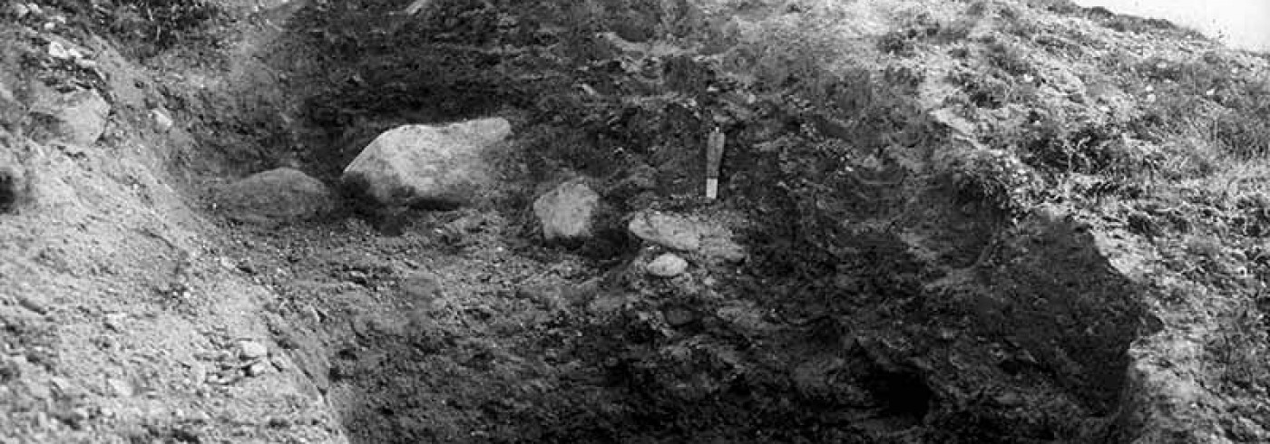
Field-work at Shpindler Cape, Yugorsky Peninsula during the summer of 1998 revealeda complex stratigraphy with at least six lithostratigraphical units. The lowermost exposed unit is a clayey-silty unit, interpreted as an interglacial marine deposit due to its content of a diverse boreal molluscan fauna. The occurrences of subglacial till units in the stratigraphy indicate at least one glacial advance prior to 12 ka. and after >45 ka. Glaciotectonic folding and thrusting of the underlying sediments indicate ice moving from the north, out of the Kara Sea basin and on to land. A second ice advance may have occurred prior to 12 ka. This advance is inferred from the occurrence of a diamicton in the stratigraphy, interpreted as a subglacial deposit, that was documented in the upper part of the sections. Underlying deformed sediments show stress from the south-south-east.
Shpindler Cape, Yugorsky Peninsula 1999
Field-work during this field season revealed that the investigated sections show evidence of more than one glacial overriding. The ages of the glacial events remain uncertain and the work of interpreting the glaciotectonics and the glacial history is still in progress. In addition to last year’s dating programme, samples from the units below and above the glacial deposits have been submitted for AMS 14C dating, and molluscs from the lowermost exposed interglacial marine unit have been submitted for amino acid analyses.
Dates
8 July–16 August 1999
Participants
Principal investigator
Ólafur lngólfsson*
Earth Sciences Centre, University of Gothenburg
Sweden
Principal investigator
Steven L. Forman*
University of Illinois
Chicago, USA
Torbjörn Andersson*
Earth Sciences Centre, University of Gothenburg
Sweden
Andrei Andreev*
Institute of Geography, Russian Academy of Sciences
Moscow, Russia
Valery Gataullin
Oil and Gas Research Institute
Riga, Latvia
Marina Leibman
Earth and Cryosphere Institute
Moscow, Russia
Hanna Lokrantz
Earth Sciences Centre, University of Gothenburg
Sweden
Björn Magnor
Earth Sciences Centre, University of Gothenburg
Sweden
William Manley*
University of Colorado
Boulder, USA
Torbjörn Persson
Earth Sciences Centre, University of Gothenburg
Sweden
Per Samuelsson
Earth Sciences Centre, University of Gothenburg
Sweden
Alexander A. Vasiliev
Earth and Cryosphere Institute
Moscow, Russia
*Not participating in the expedition
References
Forman, S. L., Ingólfsson, Ó., Gataullin, V., Manley, W. F. and Lokrantz, H. (1999). Late Quaternary stratigraphy of western Yamal. Peninsula, Russia: New constraints on the configuration of the Eurasian ice sheet. Geology 27, 807-810.