A cosmogenic approach to the glacial history of Greenland
6 July 2004 - 17 August 2004
Sampling for cosmogenic exposure dating. Photo: Lena Håkansson
During the last decades considerable efforts have been put into onshore investigations of the Late Quaternary glacial history in Greenland. This work has indicated that considerable parts of the today ice free coastal areas in NE Greenland were ice free also during the last glacial maximum, the LGM (Hjort, 1981; Funder and Hansen, 1996; Funder et al.,1998, Adrielson and Alexanderson, in press). This concept of a limited LGM-glaciation has, however, been recently challenged both by new land-based field data (Bennike and Weidick, 2001) and by marine geological studies (Evans et al., 2002; Ó Cofaigh et al., 2004), interpreted as indicating extensive LGM-ice reaching towards the shelf-break.
On both the north-eastern and western high coastal plateaux of Greenland considerable amounts of glacially transported boulders are found. The exact age of these is largely unknown, but they have been associated with the last shelf glaciation (Kelly, 1985; Kelly et al., 1999; Möller et al., 1994). In NE Greenland these boulders are part of the “Jameson Land Drift”, described already by Otto Nordenskjöld at the beginning of the 20th century (Nordenskjöld, 1907).
If the last time the main Greenland ice sheet, the Inland Ice, covered the shelf was indeed well before the LGM, as suggested by most earlier onshore investigations, what was then the extension and dynamic character of the LGM ice in NE Greenland? We would like to address these questions in a partly new way, using the so called cosmogenic exposure dating (CED) method, combined with different types of remote sensing techniques. So the question is: was the LGM glaciation in Greenland more extensive than earlier anticipated, covering much of the shelf area, or was it perhaps only the outlet glaciers from some of the main fjords that inundated parts of the shelf, leaving the adjacent coast and shelf areas with only that limited glaciation suggested by the earlier works?

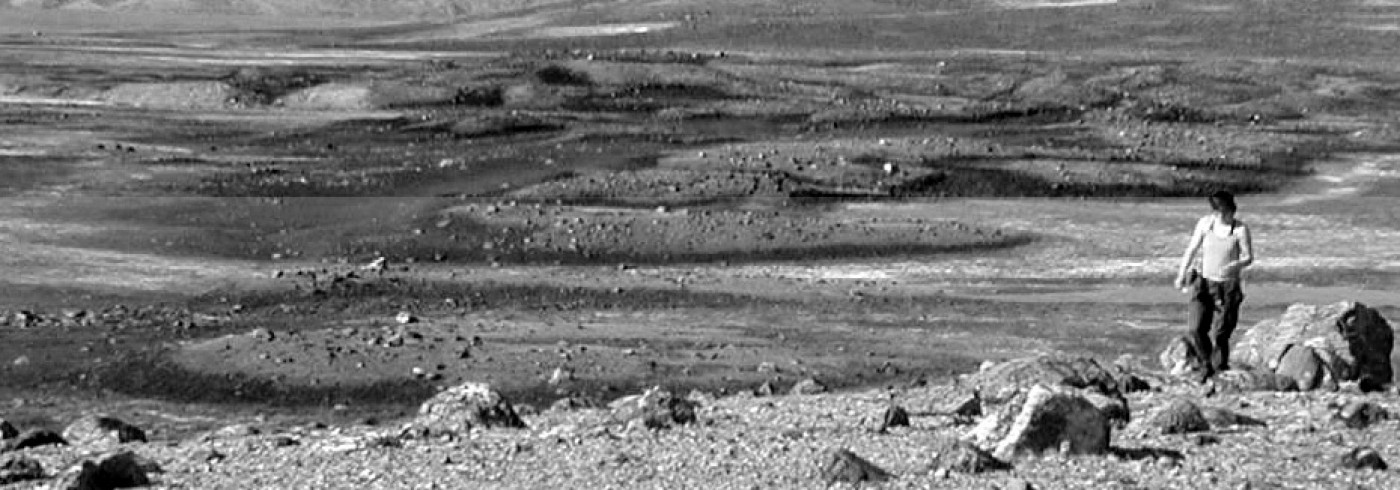
Glacially scoured basalt hills near the Mestersvig air-field, covered by erratic boulders which date the final, post-LGM, deglaciation of the area. Photo: Lena Håkansson
Cosmogenic exposure dating
CED provides a measure of the time a rock surface has been exposed to cosmic radiation. When cosmic rays interact with the nucleus of an atom, cosmogenic nuclides are produced (Gosse and Phillips, 2001). Most of this production takes place in the atmosphere, but it also occurs in the uppermost few meters of the lithosphere. There it takes place within the minerals, of which quartz is most commonly used for analyses. Its simple chemical composition (SiO2), its resistance to erosion and weathering processes and its abundance in many rock types make it an ideal mineral for the study of cosmogenic nuclides like 10Be and 26Al. When first accumulated within a rock there are two processes acting to reduce the amount of these nuclides; the radioactive decay and erosion.
The accumulated amounts of these nuclides indicate the timing of deglaciation, when assuming that the ice once covering the sampled rock surface eroded away enough material to erase the accumulation from earlier exposures. This is, however, not always the case. If the erosion was not sufficient to achieve this “zeroing”, the rock will be left with a nuclide inheritance from earlier exposures, which will make the sample dating come out older than it is.
By using the different decay rates of 10Be and 26Al it is possible to find out whether the sampled surface has experienced multiple episodes of burial and exposure. It is, however, not possible, based on the relative decay of 10Be and 26Al, to further evaluate the duration and timing of the individual episodes. A complex exposure history implies that the surface has been covered several times, but without suffering very much erosion – e.g. by the cover being cold-based, mainly non-erosive ice-caps. The CED method can thus both give direct age estimates of the deglaciation, and information about the thermal regimes of former ice sheets, by indicating whether they were actively eroding their substratum or not (Miller et al., 2002).
A pilot study 2003
In 2003 a CED pilot study was carried out on the Store Koldewey and Geographical Society islands in NE Greenland (Hjort et al., 2004). The main aim of sampling glacially transported boulders on the high plateaux (600-800 meters above sea level) on Store Koldewey, situated immediately inside the continental shelf, was to try dating the original onset of large scale glaciation in NE Greenland. The dating results from that expedition are, however, so far only preliminary.

Map of NE Greenland showing localities for the fieldwork during the summers of 2003 and 2004.
Fieldwork 2004
The fieldwork during this summer again focused on CED sampling, and was carried out in the NE Greenland fjord zone between 70°-75°N (figure 1). This is a region dominated by deep fjords separating gently undulating mountain plateaux which reach 1 000-2 500 metres above sea level. Although local glaciation may be extensive, especially among the highest mountains, the area is mainly ice-free today.
During six weeks (6 July-17 August) we worked in three main areas, accessed through the air-fields at Constable Pynt, Mestersvig and Zackenberg. Transport between these areas was with Twin Otter aircraft, and further into the field with helicopter, rubber boat or by foot. The logistics were coordinated by the Danish Polar Center. Work was carried out from tent camps, except for around the Zackenberg research station.
Constable Pynt (7–12 July)
J.P. Koch´s Fjeld is situated west of Constable Pynt and was one of the most important localities for the study of older glaciations during the Polar North Atlantic Margins (PONAM) project in the early 1990s (Möller et al., 1994). It is an approximately 900 m high basalt-capped mountain surrounded by mesozoic sedimentary rocks which form flat plateaux between 770-830 metres above sea level south and east of the summit. A sheet of the “Jameson Land Drift” covers these plateaux but is not found at the top of J.P. Koch´s Fjeld itself. At some places on the plateaux the drift exhibits fresh-looking mounds and ridges. Bedrock is exposed as weathered tors along the plateau edges.
Samples for CED were collected from the boulders of the “Jameson Land Drift”. During earlier investigations the glaciofluvial mounds and ridges were termoluminescence (TL) dated. In parallel with the CED dating we will now re-date these landforms with a related but newer method, the optically stimulated luminescence (OSL) technique.

Sampling for optically stimulated luminescence (OSL) dating. Photo: Helena Alexanderson
Mestersvig (13–20 July)
The glacial history of this area was investigated during the 1960s and1970s (Washburn and Stuiver, 1962; Lasca, 1969; Hjort, 1979). It is a mountainous area on the south side of the deep Kong Oscars Fjord, with undulating high plateaux reaching about 1000 metre above sea level, and further west in the more alpine Staunings Alper up to 2500 metres above sea level. The Marine Limit (ML) around Mestersvig lies at approximately 110 metre above sea level and is marked by several deltas. Distinct lateral moraines can be followed along the mountain slopes, at approximate 400 metre above sea level, but glacially transported boulders also occur above this level, although not to the very summits.
Rock samples for CED were collected from glacially transported (“erratic”) boulders on glacially scoured bedrock just above the ML (photo 2). These should, together with OSL samples from a delta at the ML (photo 3), date the final deglaciation of the area. Additionally, boulders from both the suspected LGM lateral moraines and from areas above them were sampled (photo 4).

A boulder above the main lateral moraine (the main “trimline”) near Mestersvig, sampled for cosmogenic exposure dating. Photo: Lena Håkansson
Tyrolerfjord, Zackenberg, Kap Herschell (20 July–17 August)
These working areas made up a W-E transect from the inner fjords, approximately 30 km from today’s edge of the Inland Ice, to the outer coast. Rather flat plateaux reaching between 600-1 500 metre above sea level dominate along the transect, but there are also mountains of a more alpine character. In Tyrolerfjord, the area furthest inland, the valleys are mainly covered by ground moraine, in Zackenberg partly by more hummocky moraines (photo 5), and at Kap Herschell on the outer coast the glacial input is mostly scattered erratics. However, in the latter area there is also a prominent moraine ridge, the Herschellhus Moraine, described by Houmark- Nielsen et al. (1994), which can be followed for around 5 km along the coast. Continuous “trimlines” are observed on the fjord- and valley sides around 500 metre above sea level, near Zackenberg and west thereof. On the very top of the high mountain plateaux glacially transported boulders were only observed at localities close to the outer coast, near Kap Herschell.
Sampling for CED (photo 1) was carried out above and below the “trimlines” along a transect from central Tyrolerfjord eastwards via Zackenberg to the outer coast, and in the latter area both on top of the Herschellhus Moraine and on the high plateaux above Kap Herschell.

Hummocky moraines in the Zackenberg river valley. Photo: Helena Alexanderson
Sampling strategies
According to the earlier work on land much higher ground and some coastal areas in NE Greenland were ice free during the last glaciation (LGM), when the main glaciers were topographically controlled and limited to the fjord basins (Funder et al., 1998). With respect to especially the new marine geological results (Evans et al., 2002; Ó Cofaigh et al., 2004) we would, however, now like to test if the ice extent was indeed that limited. By employing the CED technique to key landforms representing different stages of glaciation, mapped both by different remote sensing techniques and in the field, it should be possible to put also the older glacial events into a chronological context. In addition it should be possible to find out more about the thermal regimes of the former glaciations, e.g. whether the ice was actively eroding its bed or frozen to it.
Another field season is planned for the summer of 2005, back Constable Pynt and the “Jameson Land Drift”.