Oceanography – CTD measurements
31 July 2009 - 10 September 2009
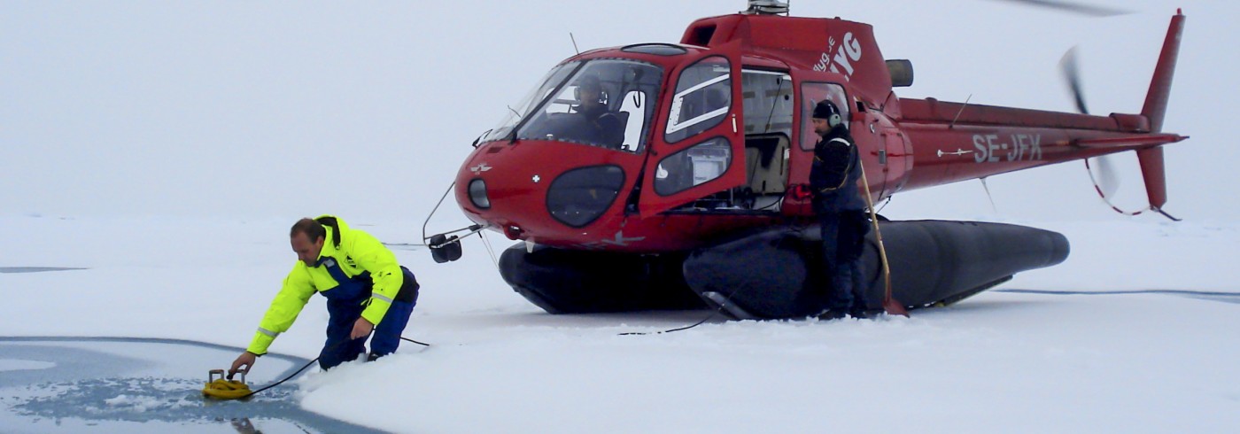
CTD station on sea ice. The SBE 19plusV2 CTD (centre) has just been retrieved. The mobile winch (blue) holds 2 000 m of synthetic rope and is powered by a generator. A Niskin-type bottle for water sampling lies in the snow. The winch is configured in boom assembly for working over the ice edge and the wire counter hangs over the open water. In the background, Kajsa Tönnesson, University of Gothenburg, is packing up her plankton nets with assistance from the helicopter pilot.
Photo: Steffen M. Olsen
Knowledge of variations in water mass distribution along the cruise track is required for calibration of multibeam bathymetric data. The primary purpose of the oceanographic work during LOMROG II was thus to supply representative, near real time vertical profiles of sound velocity derived from CTD measurements of temperature, salinity and pressure as a function of depth. Data are collected either from the ship during stations or from ‘satellite’ stations on the sea ice reached by helicopter. Making optimal and synergetic use of resources, a number of add-on science projects dependent on oceanographic CTD measurements and collection of water samples accompanied the continental shelf project.
The oceanographic data acquired will contribute to the understanding of Atlantic water circulation in the Amundsen Basin in particular, and will yield an updated view of the state of the polar mixed layer and halocline structure in the area along the Lomonosov Ridge. Stations were also planned in the central region of deep exchange across the ridge as identified by the HOTRAX expedition in 2005, presumably of Canadian Basin deep water from the Makarov Basin towards the Amundsen Basin. LOMROG I oceanographic data acquired closer to Greenland indirectly confirmed the existence of such exchange. LOMROG II data will potentially document the persistence of this exchange, partly by collecting data in the actual channels of exchange, a region also of interest to the paleoceanographic science team onboard.

Station map including ship stations (yellow) and CTD stations from sea ice reached by helicopter (purple).
In total 16 unique ship stations and 20 CTD stations on sea ice was completed (figure). Station work commenced during the transit track with relatively coarse spacing but was intensified in the study area along the Lomonosov Ridge including the intrabasin of the ridge. Ship stations made use of the onboard CTD rosette system owned by the University of Gothenburg and consisting of a 24-bottle rosette sampler equipped with 7.5-l Niskin type bottles. Ice stations were reached by helicopter where we made use of a pumped SEACAT in profiling mode in combination with a portable winch with 2 000 m non-conductive line (picture). Limited water was collected using just a single Niskin bottle by drop-messenger triggering.