LASHIPA 4 – Natural resources and geo-politics from 1600 to the present, cases from Grønfjorden, Svalbard
2 August 2007 - 25 August 2007
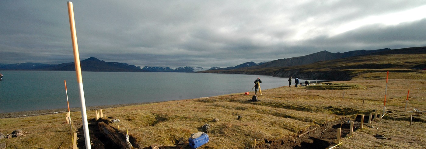
Survey along the riverbed at Sandefjord Point on the southwest side of Grønfjorden, in search of claim boards and remains of water collecting devices. The river coming down from the mountain was used as a fresh water source for the Finneset whaling station. Photo: Dag Avango.
Introduction – aim, questions, research problems, methods and theoretical approaches
The LASHIPA project (Large Scale HIstorical Exploitation of Polar Areas) is an endorsed and financed research project within the International Polar Year 2007–2008, with participants from the Netherlands, Sweden, USA, Great Britain, Norway and Russia. The aim of the project is to explain the development of natural resource exploitation in the polar areas from the 17th century until today, and the ensuing consequences for the geopolitical situation and the local environment. The main research questions are: why, how and under what economical and geopolitical circumstances have the natural resources in the Polar Regions been explored and exploited? What was the role of the industrial settlements and stations in this process? What were the economic results and what were the consequences for the natural environment and the geopolitical situation? The project seeks its explanations and understandings from an international comparative and bi-polar perspective, breaking away from national frameworks common in previous research on polar history. It is a multidisciplinary project, with its emphasis on the disciplines of Historical Archaeology and Industrial Archaeology (Avango, Hacquebord et al., 2006).
The research is based both on documentary evidence from the archives of commercial companies and governments, and on archaeological investigations of material remains of the exploitation activities in the polar areas. The LASHIPA project has selected three areas as targets for case studies – Spitsbergen in the Arctic (sealing, whaling and hunting in the 17th and 20th century, mining in the 20th–21st century, oil and gas in the 20th century), and South Georgia and Deception Island in the Antarctic (sealing and whaling in the 20th century). These areas have been focal points for international competition over both natural resources and political influence through the course of their history. Moreover, they contain rich archaeological remains. Therefore, these are areas where the research problems outlined by the LASHIPA project can be addressed in a limited geographical context.

Ypie Aalders, Seth DePasqual and Ulf Gustafsson mapping remains of Arctic Coal Company test pits at the northwestern entrance of Adventdalen, as part of the field research of LASHIPA participants from MTU. Photo: Dag Avango.
The LASHIPA project has conducted three Spitsbergen field campaigns previous to 2007: In August 2004, the LASHIPA 1 expedition mapped remains of mining camps in the Isfjorden region. In August 2005 the LASHIPA 2 expedition mapped remains of mining and whaling sites at Bohemanneset and Grønfjorden. In August 2006 the LASHIPA 3 expedition mapped whaling, hunting and mining stations in various locations in the Isfjorden and Bellsund regions, in order to identify and select sites that could be used for archaeological investigations during the International Polar Year. At least three more field campaigns are planned within the project: LASHIPA 5 at Grønfjorden on Spitsbergen in the summer of 2008, LASHIPA 6 at South Georgia in March 2009 and LASHIPA 7 at South Shetland in 2010 (Avango, Martin et al. 2005; Avango and Hacquebord 2006; Avango, Hacquebord et al., 2007).
The data from the field campaigns are used to deal with several of the main research problems in the LASHIPA project. Two of those concern transfer of technology and the design of technology. We want to know what strategies were used to adapt technology from the temperate zone to the harsh natural conditions of the polar areas and why? Closely related problems concern the design of industrial communities and the social organisation of production. Here, we are interested in how different national actors tried to establish social order under no-man’s-land conditions and isolated geographical circumstances and why they made the choices they did. Another important research problem concerns the strategies employed by different actors to establish and legitimize claims to natural resources, and the manner in which they sought to achieve national influence by using symbols and rituals of possession in the polar landscapes. Finally, an important research problem concerns the impact of exploitation activities on the local natural environment. Using a comparative approach, we are studying different attitudes towards natural resources before and after the industrial revolution, and different approaches to the natural environment between actors from different nations. What was the impact of the different approaches to the environment, and what can we learn from this knowledge?

Field work areas of LASHIPA 4. 1) Adventfjorden, 2) Finneset, 3) Barentsburg, 4) Kokerineset, 5) Russekeila, 6) Sandefjordneset and 7) Kap Laila.
The specific objectives of the LASHIPA 4 expedition in August 2007 were to gather archaeological evidence from whaling and mining sites at Grønfjorden and Adventdalen. The scientific aims were closely tied to the overall objectives and research questions of LASHIPA (described above), as well as to the individual sub-projects of the participants (PhD theses, post-doc projects etc.) The expedition team was subdivided into three task groups – one mapping remains of mining in Adventdalen, the second mapping remains of whaling and mining on the east side of Grønfjorden and the third conducting an archaeological excavation of a hunters and whaling station at Kokerineset on the western side of the same fiord.
Fieldwork at the Longyear and Advent Valleys
The fieldwork in Longyeardalen and Adventdalen was first and foremost a part of the research of the team members from the Michigan Technological University (MTU). The team focused its efforts on the historical remains of a US company, the Arctic Coal Company (ACC), which was active on Spitsbergen between 1905 and 1916. Their investigations built on the results of the LASHIPA 1 field campaign in 2004, when much of the remains of the former Longyear settlement and the ACC mine nr. 1 were documented. This year’s survey efforts examined the way the company analyzed the extension of the coal seams in the landscape surrounding Longyearbyen and how they were used for mining. The surveys covered large areas around the Longyear and Advent Valleys, mapping remains of prospecting mines and claim huts. All finds were mapped using a TRIMBLE GeoXT GPS and some structures were also mapped with a Total Station.
Fieldwork on the east bank of Grønfjorden
The LASHIPA team on the east side of Grønfjorden consisted of Swedish, Dutch and American historians and archaeologists. The team was stationed at the Research Station Barentsburg (belonging to the Kola Science Centre of the Russian Academy of Sciences). The team worked in Barentsburg and its surroundings from 5 to 23 August and consisted of Dr. Dag Avango (project/team leader), doctoral students Ulf Gustafsson, Hidde De Haas (all from Arctic Centre, University of Groningen) and doctoral student Cameron Hartnell and master student Seth DePasqual (MTU). The team had a total of five main tasks to accomplish in the field.

Workers housing in Barentsburg, built during the 1980s, during the Soviet era. By comparing the design of mining communities in the High Arctic, we can understand different strategies for establishing social control in isolated industrial communities, as well as strategies for symbolically manifesting national presence and perhaps political systems. Photo: Dag Avango.
The first task was to document an early 20th century whaling station at Finneset, as a part of the PhD thesis work of Ulf Gustafsson. The station was built in 1905, in the wake of the 1904 national ban on whaling on mainland Norway, and was in operation until 1912 (and again in 1920 and 1926–27). During the course of these years, the station at Finneset underwent several technical and constructional changes.
The second fieldwork task at Finneset (and part of the post-doc research of Dag Avango) was to document the remains of a radio station, erected in 1911 by the Norwegian telegraph company. The radio station provided the first communication service between Spitsbergen and the Scandinavian mainland, and was therefore of great importance to the mining companies operating on Western Spitsbergen. Moreover, the radio station were used by the Norwegian government to strengthen its position in the ongoing negotiations in the 1910s about the legal status of Spitsbergen, which was then a no-man’s-land. Firstly, the sites were carefully surveyed, structures were identified and functions established with the aid of historical documents and photographs. Secondly, all foundations and structures were measured and sketched. Finally, all remains were mapped with a TRIMBLE GeoXT GPS as well as with a Total Station. Moreover, the stations were carefully photo documented.
The third task in the Finneset area was to map the remains of coal mining on the hill slopes between Finneset and Grøndalen, with a special focus on the remains of the Arctic Coal Company’s activities there between 1905 and 1913. Cameron Hartnell and Seth Depasqual from MTU found several mine entrances in the area. Two of them could be identified as remains of Arctic Coal Company mines and at least one as the remains of a mine used by The Green Harbour Coal Company – another mining company competing for the coal in the area in the early 20th century. All mines (including the remains of adjacent transport systems), coal stockpiles and house foundations were documented with a TRIMBLE GeoXT GPS. In addition, all remains of Arctic Coal Company and Green Harbour Coal Company activities were mapped with a Total Station.

Remains of the concrete foundation forthe coal crane of the Nederlandsche Spitsbergen Compagnie from the mid-1920s, re-used today for a conveyer belt by the Russian mining company Trust Arktikugol. Photo: Dag Avango.
The team on the east side of Grønfjorden also had several tasks to accomplish in the mining town of Barentsburg. As part of the PhD thesis work of Hidde De Haas, the fourth task was to map buildings, mines and mining installations built and used by the Dutch coal mining company Nederlandsche Spitsbergen Compagnie (NESPICO). NESPICO was the company that established Barentsburg and was active there between 1921 and 1932. With the help of historical photographs and maps, Hidde De Haas and Dag Avango carefully surveyed the entire mining town and found several structures remaining from the NESPICO mining period. A careful documentation was made with GPS technology and digital cameras, as well as measuring tape and sketch blocks. In addition, some of the building remains were documented with a Total Station.
The fifth task, as part of the comparative research conducted by Dag Avango, was to document standing buildings, mines and mining installations built and used by the Russian company Trust Arktikugol, from the Second World War to the present. The functions of the buildings and technological systems were documented by description and digital photographs.
Archaeological research on Kokerineset and the west side of Grønfjorden
The LASHIPA team on the west side of Grønfjorden included three Dutch researchers: Prof. Dr. Louwrens Hacquebord (expedition and project leader), M.A. Ypie Aalders (excavation leader), bachelor student Sara Drescher and two technical assistants, Erwin Bolhuis and photographer Ben Bekooy. Furthermore, the team included five Russian researchers: Prof. Dr. Vadim Starkov (Archaeologist, Russian team leader) Vitali Anufriev (Historian), Dr. Victor Derzhavin (Archaeologist), Maxim Derbenev (Technical assistant) and Vladimir Prokurnov (Translator, assistant).

Professor Louwrens Hacquebord and Ypie Aalders excavating the Pomor hunters station at Kokerineset. Photo: Ben Bekooy.
The Kokerineset site was discovered during the LASHIPA 2 expedition in August 2005. Traces of both whaling and hunting activities were revealed. The site was preliminarily interpreted as a whaling station from the 17th century, overlayered by a Russian Pomor hunter’s camp from the 18th and 19th century. The objective of the excavation in August 2007 was not only to test this hypothesis, but also to obtain information in regard of the way man exploited natural resources in the High Arctic during the pre-industrial period, and thus open the possibility for comparison with exploitation of natural resources in the region during the industrial period. Moreover, the study should provide an insight into the way people of two totally different cultures (17th–18th century European whalers and 18th–19th century Russian hunters) were exploiting natural resources during the pre-industrial exploitation period of Spitsbergen and into the nature of their contact with each other.
The archaeological research conducted at Kokerineset was focused on the excavation and documentation of the Pomor hunting station. Two trenches of 10 m² each were set out at the site of this hunting station. During the excavation the remains of two log houses were uncovered. Both houses form part of a larger complex of structures that were occupied during different periods. The broad contours of these structures can be traced in the landscape.
At least two culture layers could be distinguished. The finds of the lowest and oldest culture layer consisted of (mostly black) pottery shards, fragmented pieces of bone and pieces of leather and metal. The find assemblage of this layer indicates Pomor occupation. The layer further consisted of a very compact layer of bark and small pieces of wood that was situated under the floor of the log houses, indicating it was older. The second and younger culture layer contained more pieces of glazed ware that are likely to be of West-European origin, which might indicate that the Pomors bartered with the European whalers. This layer belongs to the period when the two log houses were built, probably the 19th century.

Remains of log houses revealed in the excavation. Photo: Ben Beekoy.
An interesting aspect was that the houses were built on a terrace that has been extended by the inhabitants towards the sea in subsequent periods. Because of this it is most plausible that the youngest structures on the terrace are situated closest to the sea and that the oldest structures are situated farthest inland. To test this theory however more research at the site will be needed.
An important aspect of the research was the mapping of the topography of the area together with visible archaeological remains and other characteristic features of the landscape by using a Total Station. In this way a very detailed map of the area was created.
The surveys: Kap Laila, Sandefjord Point and Russekeila
The LASHIPA 4 team also conducted three surveys. One at Kap Laila at the western entrance to the Coles Bay, with the objective of finding remains of a number of buildings erected there by the NESPICO in the 1920s. The area around Kap Laila was searched in a pedestrian reconnaissance mode, but no remains were found. The result can partly be explained by severe weather conditions. The second survey was made at Sandefjord point, a cape located on the west side of Grønfjorden, south of Kokerineset. The site was used as a fresh water resource by the whaling company active on Finneset, which also had plans to move its whaling station there. In line with our expectations, we found remains of claim boards and facilities for fresh water collection. The third survey was carried out at Russekeila, where remains of a Russian Pomor hunting station was mapped, as well as buildings and features that may pertain to mining projects conducted there in the early 20th century.

Remains of the flensing plane at Finneset whaling station. The whales were first pulled up on to the floor for cutting, and then further processed in the different production units of the station. Photo: Dag Avango.
Preliminary results
Some tentative conclusions can be made from the results of the field investigations during LASHIPA 4. From the mapping of the Finneset whaling station, most of its production line could be re-constructed and explained, as well as the function and design of its different parts. It also became clear that the plan of the station featured a strict separation between production and lodging. The station plan also expressed a social hierarchy. In addition, we revealed some of the rationale for locating the station at Finneset – favourable harbour conditions with relatively deep water close to the shoreline, protection from winds from the north and a relatively flat landscape suitable for hauling whales on shore and for erecting buildings and technical installations. Moreover, Grønfjorden is one of the most accessible fiords on Spitsbergen because of the relatively long length of its ice-free season and its location near the entrance to Isfjorden and the open sea.

Erwin Bolhuis mapping the Finneset whaling station with a total station. Photo: Dag Avango.
Many of the same qualities are relevant for understanding the rationale for locating the Norwegian radio station at Finneset. The site was within easy distance from most mining settlements of scale on Spitsbergen in 1911 and a natural place to stop over en route to or from the European mainland. Last but not least, it is well known that the Norwegian government had political ambitions invested in the radio station to further its goal to establish national sovereignty over Spitsbergen. It is therefore worth noting that Finneset was the neighbourhood of several Norwegian companies, guaranteeing the station access to a harbour and to coal (for energy), as well as strengthening the impression of Norwegian effective occupation in the area.
The investigations in Barentsburg also yielded valuable results. It has been generally believed that the remains of NESPICO’s Barentsburg are, with some notable exceptions, impossible to find because of the massive destruction of the town in 1943 by the German North Atlantic fleet. However, the survey yielded impressive and unexpected results. Remains of numerous pre-war structures were found and documented, which will facilitate an understanding of the main production line and the general plan of the community, with the help of historic maps and photographs.
The mapping of Barentsburg also yielded important data for understanding the development of the town from the 1930s until today. The different time layers of the settlement revealed different Soviet architectural trends over the course of the 20th century. Moreover, it revealed different phases of re-construction and investment, most likely reflecting fluctuations in the relative importance of Spitsbergen in Russia – economically, politically and strategically. However, at this point we cannot explain the driving forces behind the different construction phases without further archival research and comparative analyses, nor the contextual meanings or symbolic values of the buildings and the settlement itself. These are important tasks for further research.

Remains of the Finneset radio station – an important asset for the mining and whaling companies active on Spitsbergen in the early 20th century and a valuable tool for Norwegian diplomacy in the struggle over the future status of the no-man’s-land. Photo: Dag Avango.
Finally, the Kokerineset excavation yielded important results as well as bases for a plan for continued excavations of the site. The excavation revealed the remains of two log cabins and under those the remains of an older period of settlement. Both cultural layers clearly indicate a Russian Pomor occupation. However, the site was also used by European whalers, which the remains of a blubber furnace near the beach clearly shows. Most likely these whalers were British, as is indicated by its design. Apart from the furnace, the excavation team found no further indication of a European presence at Kokerineset in the 17th and 18th centuries. Remains of whalers’ dwellings are expected to be found to the north or west of the 2007 excavation trenches.
The fragments of glazed- and slipware found in the upper layer point to barter between Western European whalers and Russian Pomor hunters. However, it is also possible, but not likely, that the Pomors brought the pottery from their home countries where they also engaged in barter with Europeans.
The animal bone material collected at the site was analysed in Groningen in the autumn of 2007. It provides some insight into which species the Pomors hunted. However, it is a relatively small sample. In order to answer questions in regard of the seasons during which the Pomors were hunting and the relative amounts of and uses for animals they killed, more bone material needs to be collected from a larger area. A cow bone and the Plum stones found in the excavation make barter between Pomors and the European whalers appear very likely.