Finding Mars on Svalbard: A study of Martian gullies on Earth
1 June 2007 - 31 August 2007
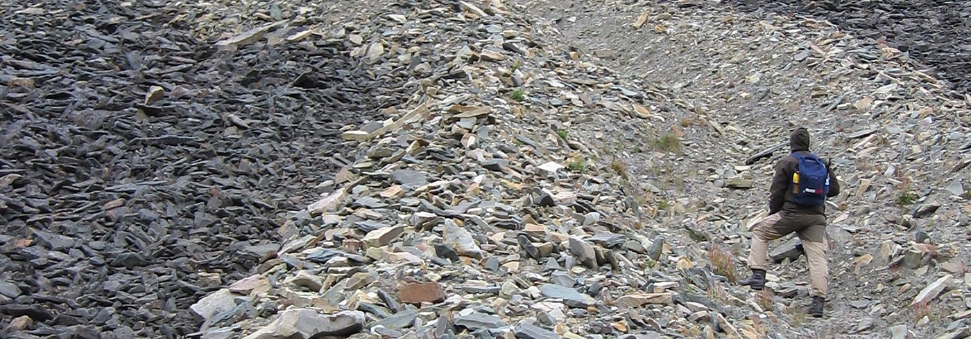
Ella Carlsson and Henrik Johansson analyzing the mountain underneath the surface using a WADI device. Photo: Expedition Svalbard 2007.
Background
Water is a prerequisite for life as we know it. Without water the present life on Earth would not exist. The quest for water on other celestial bodies beyond Earth has therefore become an imperative in space research. The planet Mars has been known to harbour abundances of frozen water trapped in its polar caps and the regolith. However, due to the low atmospheric pressure and temperature, water cannot exist in a liquid and stable form on the surface. The discovery of water-related geological features, known as gullies (Malin and Edgett, 2000), constituted a turning point in the debate regarding the existence of liquid water on the Martian surface. The discovery implied that water could exist on the surface of Mars during favourable conditions. However, identifying the exact formation processes that have been involved in the formation of these gullies has proved to be a point of contention. Different models have been proposed, including dry landslides (Treiman, 2003), liquid carbon dioxide (Musselwhite et al., 2001), snow melt (Christensen, 2003), melting ground ice (Costard et al., 2002), deep aquifers (Gaidos, 2001) and shallow water aquifers (Mellon and Phillips, 2001). So far the science community only has access to remote sensing data from satellites which, at present, cannot for certain determine the true eroding agent of the gullies.
Martian analogue gullies on Earth
On a scouting mission to Svalbard in 2006, we found gullies that bear striking similarities to the Martian gullies. The left side of figure 1 shows a gully found on Svalbard (Adventfjorden) while the right side displays a typical Martian gully. These gullies, which originate from two different planets, exhibit the same kind of characteristic features such as alcove, channel and debris apron. The theatre-shaped alcove tapers down slope where the V-shaped channel commences. Many gullies on Svalbard have consolidated strata layers in the alcove regions, which also have been detected for some of the Martian alcoves. Moreover, the channels of the gullies on Svalbard tend to streamline around obstacles in the same way as some of the Martian gullies do, which indicates that water could be one of the eroding agents on Mars as well. Another similarity is the occurrence of debris aprons in the lower part of the gullies that are triangle shaped, broadening down slope.

The left side of the figure shows a terrestrial gully on Svalbard (Adventfjorden) while the right side shows a Martian gully. Left side photo: Ella Carlsson. Right side photo: NASA/MSSS.
Methodology
The discovery of the similar morphology of the gullies became the starting point of our Expedition Svalbard 2007 and 2008. We hypothesized that terrestrial gullies in the polar regions could be an equitable analogue for the Martian gullies due to the cold climate, and a comparative analysis could help solve the discrepancies regarding the formation mechanisms of the Martian gullies and shed light on their true eroding agent.
In the study we will analyse satellite remote sensing data of analogue gully locales on Svalbard by using similar methodologies to those used in previous studies of Martian gullies (Heldmann et al., 2004 and 2007). The results will then be compared with measurements made in situ on Svalbard in order to validate the conclusions drawn from the satellite data. In addition, an extensive set of measurements, which cannot be conducted from orbit, will be made on site at Svalbard. The knowledge gained from this comparison will be used to make a qualitative evaluation of the conclusions drawn from previous studies of gully formation on Mars, where only remote sensing data is available.
Expedition Svalbard 2007 and 2008
In the summer of 2007, as part of SWEDARCTIC 2007, we first flew to Longyearbyen and initially set up camp at the camping site close to the airport. On the other side of Adventfjorden we were sometimes able to discern the gullies through the low clouds. We were standing at the shore, admiring the view, eager to reach the opposite side of the bay and begin our study.
The first couple of days were spent making sure that we had all the right equipment to survive without support for two weeks in a polar environment.
We also checked our instruments to see that everything was in order after the flight. We were then transported to the other side of Adventfjorden using a small open boat, operated by the Norwegian Polar Institute. We disembarked between Adventcity and Hjorthamn and set up our tents some hundred meters from the shoreline. Even though we could see Longyearbyen on the other side of the fjord, we knew we were in the wild and humble guests in the land of the mighty polar bears.
During the next couple of days we climbed the hills to reach the gullies. Initially, we started to study a rather small gully (250 m), which we named Idun, after one of the gods from Norse mythology. After measuring lengths, widths, depths and slope angles of the different parts of the gully, we deployed our data logging instruments. These loggers are going to measure temperature, humidity and water occurrence in the soil and air, for the next twelve months. With the use of a WADI device, which measures the magnetic component of the electromagnetic field emitted by long-distance radio transmitters, we also looked for signs of underground structures where water could be enclosed.

Andreas Johnsson climbing up in the gully he named Balder. Photo: Expedition Svalbard 2007.
Little did we know that Idun was just a precursor of what was to follow.
Not far from Idun we found another interesting gully, which we named Balder, Idun’s mythological brother. The gully Balder is at least four times longer than Idun and in some places, twice as steep so our exploration of Balder was mixed with emotions of fear and a sense of true happiness. It was a remarkable experience for us to be able to stand inside such a mighty gully, since the larger part of our party had only studied gullies on satellite images taken from high orbit around Mars. Our ultimate goal in exploring Balder was to closely observe the strata layers in the upper part of the alcove of the gully, from where the sapping water originated, but due to the very active top layer of the gully we found it impossible to reach this point, fearing that this layer could collapse. We therefore decided to revisit Balder next year with suitable climbing equipment (and helmets) in order to lower ourselves down from the top of the mountain.
After a week the Norwegian Polar Institute arrived to collect us, and this time our target was the shore of Sassenfjorden. Unfortunately the weather situation began to deteriorate and the journey crossing Isfjorden in an open and very small boat took on nightmare proportions in the high and windswept sea. While in the boat, we saw other gullies along the shoreline and we decided to cut our trip short and head for those instead, which took us to the area of the Diabas peninsula.
It took us some time to find a spot with ground sufficiently horizontal to raise our tents. It was a genuine adventure trying to set up the tents and trip wire flares (polar bear warning system) in a polar rainstorm. After a couple of hours of hard work we could finally catch some rest in our sleeping bags and we managed to fall asleep surprisingly quickly in spite of the roaring wind that strove to tear our tents apart.
When we awoke in the morning the raging noise was transformed into a strange and unidentifiable swishing sound. Emerging from our tents the sea greeted us with a calm surface and above us we could see Northern Fulmars gently riding on the breeze along the shoreline, making the swishing sound when passing over us. We all stood in awe of these magnificent birds and the surrounding breathtaking polar landscape of Svalbard that we were so fortunate to visit and study.
We plan to return to Svalbard in the summer of 2008 to retrieve the data loggers and make additional sets of measurements, which we require in order to complete our comparative study. This will hopefully help us to better understand the conundrum of the Martian gullies.
This project is also part of the IPY (International Polar Year) project # 432, where the polar regions of Earth will be investigated in order to facilitate the interpretation of the data from the Phoenix Lander on Mars.