Yesterday’s journey back was pretty fast. Got up at 07.00 to check the weather: clouds around the mountains at ca. 600 m and lower clouds pressing in from the east. The governor’s office probably knew why they chose Wednesday and Thursday for their flights… After breakfast I called Airlift with the local weather report. The pilot wasn’t that positive about flying over the glaciers. Then we observed that Vardepiggen, a mountain top of 890 m, was visible, and I called a second time to hear their decision. Helicopter take off from Longyearbyen at 09.00 was confirmed. Thus, we took farewell from the wintering team at the Polish station Hornsund – thank you for all your help and a more than welcoming reception at the station! – and got ready for fieldwork.

Takeoff from Hornsund. Photo: Henning Lorenz
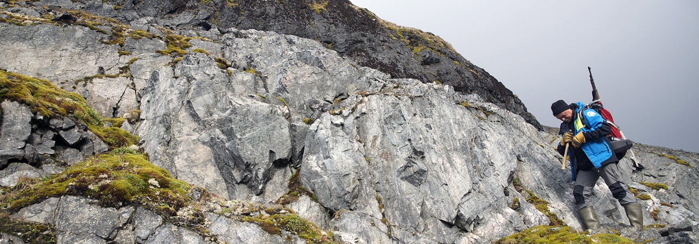
After a briefing with the pilots about our aims, we took of southwards to look at garnet-mica schists and quartzites of an unnamed unit on Sørkapp land, in order to solve the question whether this is a link between Isbørnhamna Group rocks in Hornsund and the ones we worked on at Sommerfeldtbukta. It was an impressing flight close to the coast between mountains and clouds, in close to freezing conditions. However, this helicopter is not allowed to fly in icing conditions. Together with fog on the glaciers, this was the main constraint for the pilots. Finally we approached a possible landing site on the eastern edge of Lathambreen. The pilots decided that it was too risky to shut down the engines – we needed to be quick since nobody wants to get stuck on a glacier for a week or so.

Grab-and-run sampling while the helicopter is waiting at Cuvervillefjellet, Sørkapp Land. Photo: Henning Lorenz
Thus, Majek and myself jumped out of the helicopter and did a ”grab-and-run” sampling from the outcrops about 200 m away from the helicopter. For this spot this was successful, since we saw from the air that the lithology was monotonous quartzite and we wouldn’t have found any garnet-mica schists here anyway. Then we ran back to the helicopter, got in and immediately took off. Around the edge on Olsokbreen the conditions were better and we could fly back to Hornsund directly over the glaciers, to refuel, pick up our luggage and continue to the second locality.

Gothankammen enveloped in clouds and fog. Photo: Henning Lorenz
The weather north of Hornsund seemed more promising, but the locality, Gothankammen, is higher and also in the middle of big glaciers. Gothankammen is interesting because of the possible occurrence of high-grade metamorphic rocks, which might be similar to Magnethøgda Group rocks in southern Svalbard and/or the Pinkie Formation rocks we have seen on Prins Karls Forland. Unfortunately, we couldn’t do anything to confirm this. When we arrived at the upper reaches of Torellbreen, all mountains were enveloped in clouds and fog and only the tops stuck out. Landing there is difficult anyhow and the interesting rocks are far away. Simply bad luck. Instead we sat course back to Longyearbyen and arrived in Longyearbyen earlier than expected, which allowed us to catch yesterday’s plane to Oslo and by midnight I was home.
In summary, this (expensive) part of the expedition is the only one with limited success. In all other places science was beyond expectations, despite our early departure from Sommerfeldbukta, the mishap with our Zodiac and the waiting for acceptable weather or help.
This is the last report from NOA-Svalbard and the participants want to thank everybody and all organizations who contributed to the success of this expedition. And thank you for following us during the last month!
Henning Lorenz, Uppsala universitet