Novaya Zemlya bedrock expedition 2004
27 July 2004 - 27 August 2004One of the most inaccessible bits of land anywhere on Earth is Novaya Zemlya. Located along Eurasia’s Arctic margin, this 100 km wide, 1 000 km long fold-belt reaches from the Polar Urals of northern Russia to 77°N on the continental shelf. Its accessibility is dictated today not primarily by the hostility of the normal Arctic environment, but by Russian military priorities and the atom-bomb tests in the atmosphere during the 1950s and 60s. For over sixty years, Novaya Zemlya has been out-of bounds to most non-Soviet citizens, with the exception of the occasional lucky western geologist who has been allowed to accompany Soviet surveys and, recently, archaeological and glaciological expeditions to some of the few ”permissible” areas. Hence our delight at the success of the 2004 expedition that allowed twenty bedrock geologists onto the southernmost part of the archipelago- a ”trial-run” for a more ambitious operation at 77°N in 2005.
Expedition and participants
The Novaya Zemlya 2004 party was composed of geologists from Sweden (Uppsala and Stockholm); Norway (Harstad) and the United Kingdom (Cambridge), in addition to our Russian colleagues from St. Petersburg and Moscow. Uppsala provided the western organization, coordination and leadership. The expedition was partly ship-based, being transported by the Russian Hydrographic Survey ship Gorizont on 27 July from Murmansk to Novaya Zemlya (c. 50 hours} and back on 7 August. The bedrock group included a wide range of expertise including structural geology and stratigraphy, sedimentology, palaeontology, igneous petrology and isotope geochronology, with interests ranging from the Neoproterozoic to the late Palaeozoic. Four other geoscientists, including our scientific leader from VNII Okeangeologia, Dr. Boris Vanshtein, and a naval hydrographic team were also present on the expedition ship.
Geological context
Novaya Zemlya separates the Barents from the Kara shelves and northernmost Europe from Asia. It is a vital, yet highly enigmatic link between two vast hydrocarbon provinces located in the northern parts of the West Siberian Basin and the eastern Barents Sea Basin. Novaya Zemlya provides continuity northwestwards from the classical Palaeozoic terranes of the Uralide Orogen; with its arcuate trend back northwards and eastwards it apparently connects into the Taimyr fold-and-thrust belt of northern Siberia. Thus the archipelago plays a central role in deciphering the Phanerozoic evolution of the Eurasian Arctic margin. The pre-Cenozoic tectonics of the Arctic margins also provide the essential foundation for testing alternative hypotheses for the origin and evolution of the Arctic Ocean.
Opening of the Arctic Ocean is thought to have occurred in two stages, initially in the Mesozoic and thereafter in the Cenozoic. The latter is largely uncontroversial and involved the rifting and separation of a thin sliver of continental crust from the Eurasian margin, with development of the Eurasia Basin. Seafloor-spreading magnetic anomalies parallel to the Gakkel Ridge characterize the Amundsen and Nansen basins and leave little doubt about the origin of this part of the Arctic and its close relationship to the opening of the North Atlantic. Recent expeditions (Jokat et al., 2003) have provided much new insight in to the character of the Gakkel spreading centre.
Much more obscure is the evolution of the Amerasia Basin and particularly the vast central area of so-called ”anomalous” crust that reaches across the high Arctic from Canada to Russia, and which is dominated by the volcanic complexes of the Alpha and Mendeleev ridges. The Canada Basin has yielded some potential field evidence of seafloor spreading, probably of late Mesozoic age, and a dominating hypothesis has emerged that considers the opening of the Amerasia Basin to be essentially controlled by Mesozoic seafloor spreading, involving the movement of Alaska away from the Canadian margin; the approx. 70° of rotation required for the opening of the Canada Basin is inferred to have been taken up on a major transcurrent fault along the northern edge of Lomonosov, all these displacements occurring prior to the opening of the Eurasia Basin. This hypothesis considers the Alpha-Mendeleev crust to be essentially of ocean-island character, defining the track of a Mesozoic mantle plume. We know too little about this vast central high Arctic province to dismiss alternative interpretations. The best way to test them (apart from deep drilling) is to analyse the Mesozoic and earlier structures of the Arctic continental margins, to compare and, if possible, to correlate.
Novaya Zemlya’s bedrock geology (Korago et al., in Gee and Pease 2004) is dominated by a fold-and-thrust belt that connects southeastwards via Vaigach Island and Pai-Khoi into the Polar Urals. The geometry of Novaya Zemlya structures is comparable with that along the western front of the Urals. However the classical characteristics of the Uralide Orogen (Perez-Estaun et al., 1997) – the ocean-derived ophiolites and island-are volcanics, thrust over high to ultra-high pressure eclogite-bearing allochthons of continental margin affinities – do not reach north of the Urals. Additionally, the Novaya Zemlya deformation is a few million years younger ( latest Triassic to early Jurassic) than in the classical Uralian terranes to the south. Nevertheless structural continuity exists from southern Novaya Zemlya far to the southeast through Pai-Khoi to the northernmost Urals.
Major folds in southern and northern Novaya Zemlya, the Yuzhnonovozemelskaya and Severonovozemelskaya anticlines respectively, control the bedrock structure of the archipelago. Palaeozoic successions dominate; however from the vicinity of the Matochkin Shar Strait (separating North and South islands) to the northeast, thrusting in the overturned limb of the Severozemel skaya Anticline involves the intercalation of minor slices of Proterozoic basement. The latter also occur in southwestern areas along the Kara Strait.
2004 targets
The 2004 expedition concentrated on the geology in the vicinity to the northwest of the Kara Strait. In this area, the fold axes in southernmost exposures of the Yuzhnonovozemelskaya Anticline plunge gently northwestwards and late Neoproterozoic rocks are exposed in the core of the major fold. Low greenschist facies turbidites and black shales/phyllites in the basement, variously intruded by dolerites, gabbros and lamprophyres are overlain, with major unconformity, by Early Ordovician and younger Palaeozoic carbonate-dominated successions which reach into the Early Carboniferous in the coastal areas along the Kara Strait.
The basement complex is clearly a part of the Timandie Orogen (Gee and Pease, 2004 ), involving accretion of Neoproterozoic terranes and microcontinents to the northeastern margin (present day coordinates) of the East European Craton during the Vendian. Timanian Orogeny occurred immediately prior to or during the separation of this part of Europe to form an independent continent- Baltica, by the early Cambrian. Ordovician and younger Palaeozoic successions were deposited along the passive margin of Baltica during development of the Uralian Ocean. The Novaya Zemlya successions provide little evidence for the early closure of this ocean in the Devonian, the main response to Uralian Orogeny appearing in the thick Permian turbidites and Triassic molasse.
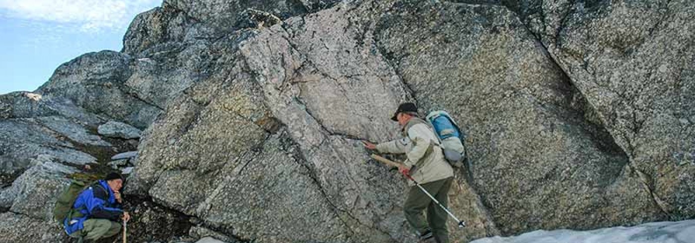
On Novaya Zemlya we split into two main groups, those focusing on the Neoproterozoic rocks and unconformable relationships to the overlying Palaeozoic (Ordovician) strata, and others concerned with the younger Ordovivian, Silurian, Devonian and Carboniferous successions.
The ”Neoproterozoic ” group worked form two camps located on the basement complex, near the unconformably overlying Ordovician succession. On the basis of the 1:200,000 geological Maps and descriptions provided by our Russian colleagues (Korago et al., in Gee and Pease. 2004), it was possible to analyze in more detail some of the stratigraphic and structural relationships to better understand the complexity of Timanian deformation and metamorphism prior to Cambrian uplift, erosion and Ordovician deposition. Local inversion of the Neoproterozoic turbidites beneath basal Ordovician sandstones provided evidence of the intensity of the Timanian Orogeny.
The ”Palaeozoic ” group examined in detail the Ordovician to Early Carboniferous successions in both limbs of the Yuzhnonovozemelskaya Anticline. The entire group started in the southwestern limb and then split into two parts to allow closer analysis of both the Ordovician-Silurian and Devonian-Carboniferous successions, the latter in the northern limb of the anticline. Sea ice hindered the use of the boats, with the result that these youngest successions were accessible only on foot, involving long treks across the tundra.
Samples were collected for studies of structure, sedimentology, petrology, diagenesis, provenance, palaeontology, geochronology, palaeomagnetism and uplift history.
Concluding remarks
The plans for this expedition were modified repeatedly due to the changing financial circumstance of some of our partners. The length of the expedition was much reduced due to the last-minute withdrawal of YUKOS group, concerned with bottom sampling in the southern Barents Sea. Nevertheless the expedition succeeded thanks to the talents of our Russian colleagues for handling unpredicted changes, the he helpfulness of the crew of Gorizont, two weeks of exceptionally stable, sunny weather, and an apparent agreement with in the local polar bear community to keep out of the way for 90% of the time. The last two ” favours” can hardly be expected in 2005!
Acknowledgements
The Novaya Zemlya expedition 2004 was the latest (since 1990) of a series of SWEDARCTIC investigations of the Eurasian Arctic margin, reaching from Svalbard in the west to Severnaya Zemlya in the east. Collaboration with our many Russian friends and colleagues has been promoted over the years within the framework of a series of INTAS (International Association for the promotion of co-operation with scientists from the New Independent States of the former Soviet Union) projects HALE, TAIMYR and NEMLOR. The science plans have been developed within the European Science foundation’s EUROPROBE programme, the later an International Lithosphere Programme initiative. The key to success in 2004 was undoubtedly our partnership with the Russian Naval authorities in Murmansk, a relationship that was made possible thanks to the last few years of close cooperation between the Navy’s Hydrographic Office and VNII Okeangelogia (the AII-Russian Research Institute for Geology and Mineral Resources of the World Oceans) in St. Petersburg. In particular, we thank Dr. Georgy A. Cherkashov and Dr. Boris G. Vanshtein (VNII Okeangeologia) and Commander Andrey S. Bogdanov (Hydrograhic Office). The support provided by our hosts on board of Gorizont, Captain Yuri Mischenkov and his crew was , also greatly appreciated.