Relative sea level changes in the southern Greenland sector after the last glacial maximum
1 August 2002 - 31 August 2002
The old fishing-boat Puttut served as base camp and transportation for one week. Photo: Niklas Sparrenbom
Background
A number of natural processes interact to cause sea level changes. The sea level position is at every point in time and space determined by the volume and shape of the oceans, redistribution of water within the ocean basins and vertical movements of the coastal areas. These parameters are driven by internal earth processes such as movement in the mantle and flexure or movement in the crust, as well as external processes such as ice sheet growth and decay, sediment deposition in the oceans basins (infilling) and also, on a smaller scale, temperature changes of the ocean water. The various processes act on different temporal and spatial scales, which creates a complex pattern of local sea level changes.
During the transition from the last glacial maximum to the Holocene period, large and rapid climatic changes caused most of the northern hemisphere ice sheets to decay. Although the Greenland ice sheet experienced considerable reduction in its size during this global deglaciation, it is today the only ice sheet left in the northern hemisphere. The exact extent and thickness of the Greenland ice sheet during the last glacial maximum still remain uncertain, as do the timing and rates of recession (Bennike et al., 2002).
Krabill et al. (1999) and Thomas (2001) recently reported observations of significant changes in the near-coastal regions of the Greenland ice sheet, with widespread and rapid thinning of outlet glaciers during the 1990’s. As melting seems to occur fairly rapidly, it is crucial for future planning and predictions to gain an understanding of the Greenland ice sheet’s response to climate changes and relative sea level changes caused by the melting of polar ice sheets.

Performing reconnaissance by horse in the Qassiarsuk–Nunataaq area. Photo: Carlotte J. Sparrenbom
Aims of the project
In this project we aim to reconstruct relative sea level changes during the last 14 000 years in south Greenland. Knowledge of these changes will help us to reconstruct the ice sheet history of south-west Greenland for the same time period by geophysical-glaciological modelling.
Only sparse information on relative sea level changes in the south Greenland sector was available before Bennike and Björck’s (2000) shore displacement curve was published and Bennike et al.’s (2001) sea level analysis was presented. During 2001 our project group worked in the Nanortalik area to complement Bennike and Björck’s (2000) sea level change data by obtaining data below present-day sea level. During the summer of 2002 the group worked in the Qaqortoq-Narsarsuaq area to complement these investigations with yet another sea level curve in a neighbouring area.

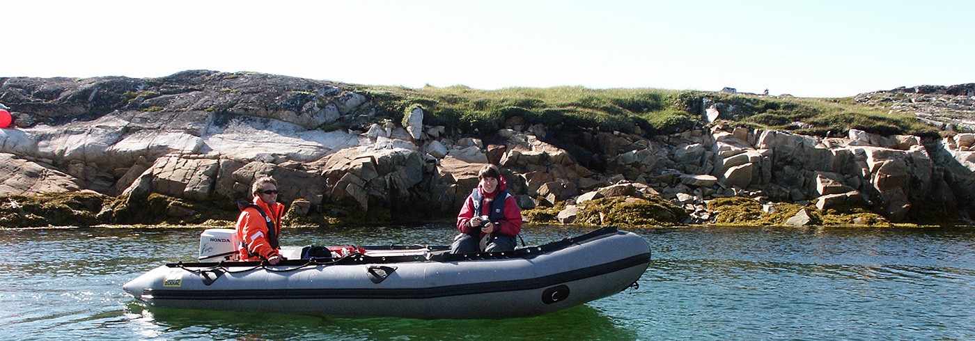
Reconnaissance and transport by Zodiac. Photo: Niklas Sparrenbom
To obtain records of past relative sea level changes, we core sediments in small local basins, i.e. lakes, lagoons and bays with appropriate thresholds. During the course of their development the studied basins should, to be useful for the investigation, have been isolated from the sea and/or inundated by seawater. Basins situated below the past marine limit have been isolated as a consequence of the earth’s uplift following deglaciation after the last glacial maximum. Basins at low altitude have been submerged in their fairly recent history. Possible hypotheses regarding this late relative sea level rise are that they may be a consequence of either a glacial advance, decay of the American inland ice sheet and/or ocean warming (water expansion) and melting of non-polar ice. Different kinds of evidence for a late glacial and early Holocene regression and a late Holocene submergence have already been found at several sites from different parts of Greenland (e.g. Long et al., 1999 and Kuijpers et al., 1999).
Investigation area
South-west Greenland is a fjord-dominated landscape, with deep fjords reaching depths over 600 m and high alpine mountains reaching 1 500 m and 2 000 m further inland. The ice-free land area is around 100 km wide and the shelf is rather narrow. Glacially abraded, rounded and flat top mountains are common in the outer archipelago, especially at the mouth of the fjords. Lakes and lagoons are plentiful in the landscape and the vegetation is characterised by dwarf-shrub heath, mosses and lichens. During winter, the snow cover in the Kap Farvel area is deep and continuous, apart from windswept ridges. “Storisen”, a wide zone of pack ice following the East Greenland Current, reaches the area in late winter (around March) and melts off during the summer. The zone of marked pack ice normally disappears from the area around late June. The Greenland Current causes cool, cloudy and foggy conditions during the summer months, with mean temperatures around 5–6°C at the outer coast.

Map showing the coring and rock sampling sites.
Fieldwork
During three sunny August weeks and four rainy days we worked in the Qaqortoq-Narsarsuaq area in South Greenland. Using a Russian corer (0.5–1 m length and 5 cm or 7.5 cm in diameter), multiple core sediment sequences were collected from a total of twelve marine, brackish and fresh water basins at altitudes between –7 m and 47 m. Two large Zodiacs and, part of the time, the old fishing-boat “Puttut”, were used to do reconnaissance in the area and to transport coring equipment and people to the different coring sites. The bathymetry of the basins was investigated from a Zodiac with an echo sounder in order to find suitable sites for coring and to estimate threshold altitudes for the submarine basins. Heights above sea level were measured with a digital altimeter and a clinometer. A small specially designed Zodiac, in which a funnel hole had been constructed through the bottom, was used as a coring platform. Transport on land was mainly carried out manually, but helicopter support was received from an As 350 B2 Ecureuil for a total of 3.5 hours, four-wheel drive motorcycles were rented two days and two Icelandic horses helped us for one day.
The main target areas for the investi-gation were the Akia Island area, the Kangerluarsuk Fjord area, the Tunulliarfik Fjord area and the Tasiusaq and Nunataaq areas in the Sermilik Fjord.
Because of the abundance of icebergs in the Sermilik Fjord, our planned visit had to be modified and instead of reaching the area by boat, we established a base camp in a hostel in Qassiarsuk (Brattahlid) and used four-wheel drive motorcycles and Icelandic horses to reach the target area.
In addition, twelve rock samples were collected on mountain peaks and erratics at altitudes between 350 m and 1 000 m in the same areas. This was done in order to perform exposure dating to help constrain the ice thickness during the last glacial maximum.

Too many icebergs in the Sermilik fjord made us use four-wheel motorcycles for transport on land instead. Photo: Niklas Sparrenbom
Preliminary results
Based on preliminary field interpretations of the twelve multiple core sediment sequences that were collected during the fieldwork, ten sequences show isolation contacts with marine sediments in the bottom, with an upward transition into brackish and freshwater deposits. This is visible to the naked eye in terms of sediment colours, grain-size, and macrofossils. The colours shift from greenish grey in the marine part into more blackish dark brown when condition turn brackish and into lighter brown colours in the fresh water depositional environment. Both textures and macrofossils tell the same story and in the marine sediments we find marine fossils, for example foraminifers, marine algae and shells, while the freshwater sediments contain plant remains from Quillwort and Mare’s tail. In addition, two of the ten isolation sequences show a transgression close to the top of the sedimentary column. To establish the isolation and transgression events properly, the sediments need to be analysed thoroughly in the laboratory and macrofossils should be picked out for C-14 dating. This will be done throughout the coming year and will hopefully be sufficient as input data for the upcoming geophysical modelling.