Did ice-free areas exist on East Greenland during the peak of the last ice age?
1 August 2005 - 31 August 2005
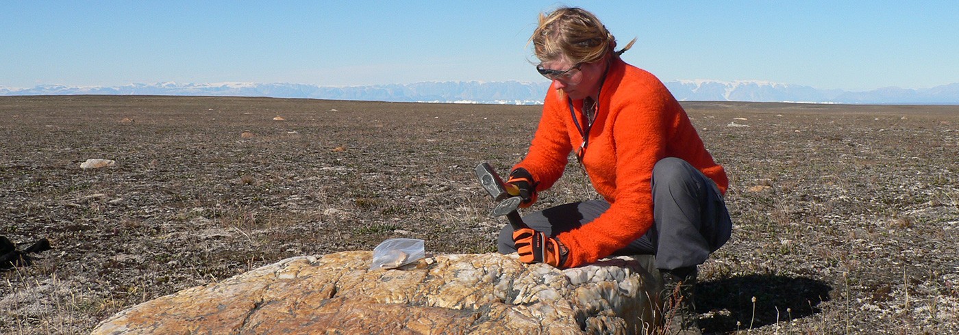
Lena is sampling a quartzite boulder for analyses of cosmogenic isotopes. Quartzites are excellent for this purpose due to their mineralogy, but are ‘hard as #@&&’ and difficult to sample. Photo: Helena Alexanderson
Scientific background and aims
The Jameson Land peninsula (70-71°N) is situated at the Scoresby Sund fjord, which is the largest drainage route for the eastern part of the Greenland ice sheet (figure). The area is ice free today, but is partly covered by glacial deposits, that indicates that glaciers have on one or several occasions advanced across the peninsula.
During the past decade considerable effort has been put into both onshore and offshore investigations of the Late Quaternary glacial history in Greenland. These investigations have led to reconstructions having outlet glaciers in the fjords during the Last Glacial Maximum (LGM; ~20,000 years ago), while leaving inter-fjord areas such as the inner parts of Jameson Land ice-free through the whole last glacial cycle (e.g. Möller et al., 1994; Funder et al., 1998, Hansen et al., 1999, Adrielsson and Alexanderson, 2005). This concept has, however, recently been challenged by marine geological studies (Evans et al., 2002, Ó Cofaigh et al., 2004) and land-based field observations (Bennike and Weidick, 2001), which indicate that the Greenland ice sheet reached the shelf break during an extensive LGM advance. The two contrasting hypotheses show that there are still many questions to be answered about the ice extent and the existence of extensive ice-free areas in the East Greenland fjord zone during the last glaciation.

Map of Jameson Land, East Greenland. The squares show our study sites at (from N to S): Umingmakbjerg/Lejrelv Valley, Ugleelv Valley, Gåseelv Valley, Fynselv River, Flakkerhuk, Kap Brewster.
Map of Jameson Land, East Greenland. The squares show our study sites at (from N to S): Umingmakbjerg/Lejrelv Valley, Ugleelv Valley, Gåseelv Valley, Fynselv River, Flakkerhuk, Kap Brewster.
Investigations in the Ugleelv Valley on central Jameson Land (Adrielsson and Alexanderson, 2005) have highlighted the effects of local glaciation in the area. The coastal Liverpool Land ice cap has on at least two occasions expanded westward onto Jameson Land, but the timing of these events is so far poorly constrained.
An increased knowledge of the nature and dynamics of ice sheets and glaciers at high latitudes is important, since changes in their extent may have large consequences for the global environment and climate. Learning more about past changes helps us to understand what is happening with the polar ice sheets and glaciers today and in the future. The aim of this project is to test the two conflicting hypotheses of ice-sheet extent and to find out more about the dynamic glacial advances from Liverpool Land by answering the following questions:
- Did ice-free areas exist in East Greenland during glacial maxima?
- When was the last time the Greenland ice sheet covered Jameson Land?
- If this took place before the Last Glacial Maximum (~20,000 years ago), what was then the extent and dynamic character of the Late Weichselian ice sheet?
- At what time(s) did the local Liverpool Land ice cap expand towards the west?
Our approach is to combine two dating methods, analyses of cosmogenic isotopes and optically stimulated luminescence dating, in an extensive effort at several sites on Jameson Land. A similar study, although mainly focused on sampling for analyses of cosmogenic isotopes, was carried out in several areas along the Northeast Greenland coast last year (Hjort et al., 2005).
Dating methods
Analyses of cosmogenic isotopes like 10Be and 26Al provide a measure of the time a rock surface has been exposed to cosmic radiation. When cosmic rays interact with the nucleus of an atom, cosmogenic isotopes are produced (Gosse and Phillips, 2001). Most of this production takes place in the atmosphere, but it also occurs in the uppermost few meters of the lithosphere. When first accumulated within a rock, two processes act to reduce the amount of these nuclides, namely radioactive decay and erosion.
The accumulated amounts of the above nuclides indicate the timing of deglaciation, assuming that the ice once covering the sampled rock surface eroded enough material to erase the accumulation from earlier exposures. This is, however, not always the case. If the erosion was not sufficient to achieve this ‘zeroing’, the rock will be left with a nuclide inheritance from earlier exposures, which will make the sample look older than it is.
By using the different decay rates of 10Be and 26Al it is possible to find out if the sampled surface has experienced multiple episodes of burial and exposure. A complex exposure history implies that the surface has been covered several times, but without suffering very much erosion – e.g. if the cover has been cold-based ice. The analyses of cosmogenic isotopes can thus both give direct age estimates of the deglaciation and information about the thermal regimes of former ice sheets by indicating whether they were actively eroding their substratum or not (Miller et al., 2002).

Helena digs into a delta in the GåseelvValley on a cold and windy day. Photo: Lena Håkansson
With optically stimulated luminescence (OSL) it is possible to determine when a grain of sand last was exposed to sunshine, which is assumed to be at the time of its deposition (Huntley and Lian, 1999). The luminescence (‘brightness’) of a quartz or feldspar grain comes from electrons that are trapped within the crystal lattice and the amount of electrons (the luminescence strength) is proportional to time (age). The method is best suited for windtransported (aeolian) sediments, which are exposed to sunlight when moving through the air, but it also gives reliable results for other deposits, for example meltwater and glacial lake sediments.
Samples for OSL dating were taken from two depositional environments on Jameson Land: aeolian and meltwater/glacial lake sediments. The aeolian sediments were deposited under cold, dry and windy conditions (polar desert) and their ages provide the timing of ice-free periods during the last glacial cycle(s). On the other hand the meltwater sediments were deposited by, or in close association with, glaciers and date advances of the Greenland ice sheet from the west and of the Liver-pool Land ice cap from the east.
Fieldwork and technology
The fieldwork was carried out during three weeks in August and our investigations focused on the six areas shown in the figure. These sites were selected based on previous knowledge of their suitability and their strategic location for this type of study (Möller et al., 1994, Adrielsson and Alexanderson, 2005). The transport between sites took place by helicopter or by foot. From small base camps we made daily excursions and visited valleys and mountain tops, studied landforms and dug into sediment exposures.

The solar panel worked fine during nice weather, but for most of the time the sun was hidden behind clouds and provided only enough light to power camera batteries. Photo: Helena Alexanderson
We used a rollable, lightweight solar panel to supply our electronic equipment (computer, satellite phone, cameras) with power (photo 3). This worked fine the first week, when we had nice weather, but later the sky was almost always overcast and light conditions were just enough to power camera batteries but nothing bigger. Subsequently our satellite phone also broke down due to a flaw in manufacture. Luckily nothing disastrous happened and we could also keep to our scheduled helicopter flights. The low-tech equipment, such as shovels and sledge hammers, did not cause any problems except for hand ache after too much use.
Sampling strategy
Greenland ice sheet advance(s)
Quartzite boulders of a western provenance occur both on the upland plateaux and on strongly weathered lower ground. To determine when the Greenland ice sheet last covered Jameson Land, these erratics were sampled for analyses of cosmogenic isotopes. OSL samples from glacilacustrine sediments at the water divide in the Ugleelv Valley will hopefully provide the timing of an event with contemporaneous Greenland ice sheet and Liverpool Land ice cap advances.
Liverpool Land coastal ice-cap advance(s)
Sequences of deltas deposited in glacial lakes dammed between advancing glaciers from Liverpool Land in the east and the water divide in the west were found in the Lejrelv and Nathorst valleys (cf. Lilliesköld and Salvigsen, 1991). The altitudes of the deltas record different lake levels and thus different lake stages belonging to more than one glacial event or to different phases of lake level lowering during deglaciation. In valleys on eastern Jameson Land there are also series of moraine ridges that formed during advances of the Liverpool Land icecap and in association with the damming of the lakes. Several samples for OSL dating were collected from the deltas and boulders from the moraine ridges were sampled for analyses of cosmogenic isotopes.
Dating ice-free periods on Jameson Land
Aeolian deposits from the Ugleelv Valley have previously been OSL-dated to 27,000 and 10,300 years ago (Adrielsson and Alexanderson, 2005). We took more samples from this site and if we can show that aeolian deposition occurred ~20,000 years ago (the LGM), this would prove that there was no ice sheet there at that time.