Late Quaternary glaciation history of Jameson Land, East Greenland
Long-term global climate modelling is partly based on proxy data obtained from glacial geological records. During the Quaternary, the Northern Hemisphere experienced the growth and decay of large continental ice-sheets. The ultimate driving force behind extensive glaciations is believed to be the Milankovitch astronomic orbital cycles (Berger et al. 1984). Repeated ice-lobe advances alternating with periods of ice-front stagnation or retreat during a single ice age are also generally considered to be driven by climatic events. However, this is only partly true, as other factors, such as topographic setting, physical and temperature conditions at the base of the glaciers, and glacial/subglacial hydrology may hamper or facilitate individual glacier advances. Thus, to interpret the glacial record correctly it is necessary to know whether an ice-lobe advance was caused exclusively by climatic changes or was mainly triggered by other mechanisms.
Two distinct modes of ice-sheet response to global climatic changes are indicated by the striking differences between glacial records from Greenland and northern Eurasia. The Greenland ice-sheet has long remained stable with only small advances. This was documented by a recent international research programme, the European Science Foundation’s PONAM project (Late Cenozoic Evolution of the Polar North Atlantic Margins), which ran between 1990 and 1994 (Funder et al. 1998). On the other hand, new data from the European Science Foundation’s QUEEN project (Quaternary Environment of the Eurasian North, 1996-), indicate large-scale rapid advances of low gradient ice-sheet lobes al o ng the northern coast of Eurasia.
Sedimentological data, from both southern Scandinavia and the northern Siberian coast, indicate that special physical and hydrological conditions occurring at the base of the ice-sheet caused instabilities which resulted in the rapid spreading of the ice masses. This suggests a complex connection between climatic factors and ice-sheet dynamics, and highlights the importance of comparative sedimentological studies of areas of contrasting ice-dynamic behaviour.
The main purpose of our project was therefore to study glacigenic sediments related to the stable Greenland ice-sheet. Jameson Land, a peninsula on the central east coast of Greenland, was chosen as representative. It was a key area in the PONAM project, and the results of that project comprise an important basis for our work. The reconstruction and dating of the glacial history of interior Jameson Land has also attracted new interest by virtue of recent investigations in the coastal areas. Indirect evidence suggests that during the last Weichselian ice age local cold-based glaciers existed in the central uplands (Hansen 1999).
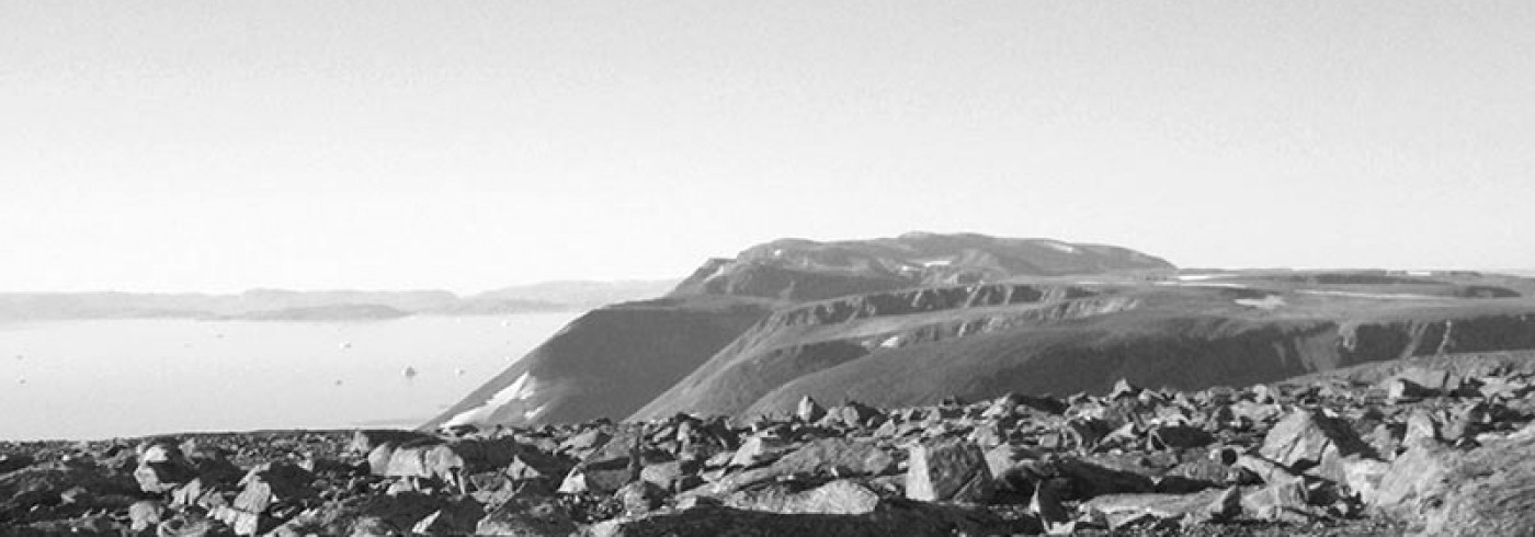
Investigation area
Jameson Land is an ice-free area surrounded by the deep Scoresby Sund fjord and by high alpine mountains capped by plateau glaciers; it is less than 200 km from the large Greenland ice-sheet. Central Jameson Land is dominated by a plateau landscape at c. 500 m.a.s.l. covered by low relief glacial sediments, originally described by Nordenskiöld (1907) as Jameson Land Drift. Despite its proximity to the present ice-sheet, there are no indications that the interior of Jameson Land was covered by the large Greenland ice-sheet during the last ice-age, the Weichselian. Thermoluminescence dating of the glacial sediments from the plateau area gives ages between 380,000 and 123,000 years, suggesting that the youngest glaciation dates from the Saalian age (Möller et al. 1994). (Thermoluminescence and optically stimulated luminescence dating techniques rely on the fact that sunlight ”bleaches” luminescence signals in some minerals so it is possible to determine the time elapsed since a grain was last exposed to sunlight, that is, burled in a sediment.)
The glacial sediments of the central plateau are exposed in the upper reaches of the Ugleelv valley. The river drains towards the east, and the valley stretches about 20 km in a NW-SE direction. A sedimentary succession more than 150m thick was briefly investigated by P. Möller and M. Lindhqvist during the very last days of the PONAM field season in 1992 (Möller et al. 1994).
Field-work
Our fieldwork on Jameson Land was carried out during three sunny weeks in July-August 2000. From Constable Pynt (Nerlerit inåt) at Hurry Fjord, a Bell 222 helicopter took us to the head of the Ugleelv Valley, where we set up camp. The chosen site was close to the section investigated in 1992. After an initial survey of the vicinity, further work was concentrated within 2-3 km of the camp. Nine localities were investigated in more detail, by sedimentological logging and sampling for optically stimulated luminescence dating, and for various laboratory analyses (e.g. clast lithology, grain size composition). In total, more than 180m of sediments were logged and 24 dating samples taken. Our field assistant, Martin, provided excellent help and also served as our cook in the evenings.
Preliminary results
Geological evidence of physical conditions related to former ice-sheets is found in sediments deposited directly at the base of the glacier, but also in sediments deposited by melt-water streams. The type of glacial erosion, entrainment of eroded material, and type of transport and deposition provide evidence of, among others, temperature and pressure at the base of the glacier. The hydrology and drainage pattern of the glacier, and the rate and type of melt-water production can be determined from the glaciofluvial sediments.
The preliminary results suggest at least two main glacier advances in the Ugleelv area and as expected, the sedimentary successions differ significantly from our sedimentary data from southern Scandinavia and the northern Siberian coast. The geology offered not only information on the glacial phases, but also much information on the climatic and environmental changes of the ice-free periods. The interpretation of the sedimentary history of the Upper Ugleelv area indicates two main phases:
- An older constructive phase dominated by deposition of thick and extensive glacial lake- and delta sediments. Those are the sediments investigated in 1992 (Möller et al. 1994). A glacial till on top of the sequence represents one of the main glacial advances recognised in this area.
- The younger sedimentary phase is typical of a land area dominated by erosional events. The development of the deeply incised Ugleelv valley represents distinct events of fluvial erosion arising from water discharges much larger than those produced by present-day snow melting. Such rivers occurred at least twice and may be related to glacier hydrology. Occasional deposition was by fluvial, glaciofluvial, aeolian and glacial processes, and the sedimentary successions are fragmentary, generally thin and of only small lateral extent. The youngest glacier advance came from Liverpool Land in the east. The lower boundary of a thin till forms an erosional unconformity towards older plateau and terrace sediments. An early period of soil formation and permafrost producing ice wedge casts is related to one of the high terraces. Periods of strong wind activity are represented by fossil dunes and by wind polished surfaces. Different wind systems dominated by south-west or north winds have occurred.
Several questions were already answered in the field, but much work remains, i.e. laboratory analyses and statistical treatment and evaluation of various measured data. A great part of the challenge is the chronology. The complex history of the glacial/interglacial cycle after the Saalian ice-age (ending ca. 125 000 years ago) covers an important time span. This span includes the early, middle and late Weichselian, which are well known in coastal areas, but of which we know almost nothing in interior Jameson Land. Stratigraphic principles can be used to establish a relative chronostratigraphy for the area, but the correlation and dating of fragmentary sedimentary sequences are greatly dependent on good absolute dating. A large number of thermoluminescence datings were performed during the PONAM project (Funder et al. 1998), but new techniques for luminescence dating have increased the possibility of dating glacigenic and other minerogenie sediments. Our optically stimulated luminescence dating samples have been sent to the laboratory in Risø, Denmark and we are eagerly awaiting the results.
Dates
July–August 2000
Participants
Principal investigator
Lena Adrielsson
Department of Quaternary Geology, Lund University
Sweden
Helena Alexanderson
Department of Quaternary Geology, Lund University
Sweden
References
Berger, A., Imbrie, J., Hays, J., Kukla, G. and Saltzman, B. (ed.) 1984. Milankovitch and climate: Understanding the response to astronomical forcing. Reidel, Dordrecht, Netherlands.
Funder, S., Hjort, C., Landvik, J. Y., Nam, S-1., Reeh, N. and Stein, R. 1998. History of a stable ice margin – East Greenland during the middle and upper Pleistocene. Quaternary Science Reviews 17, 77-123.
Hansen, L., Funder, S., Murray, A. S. and Mejdahl, V. 1999. Luminescence dating of the last Weichselian glacier advance in East Greenland. Quaternary Geochronology 18, 179-190.
Möller, P., Hjort, C., Adrielsson, L. and Salvigsen, O. 1994. Glacial history of interior Jameson Land, East Greenland. Boreas 23, 320-348.
Nordenskiöld, O. 1907. On the geology and physical geography of East Greenland. Meddelelser om Grønland 28, 151-284.