Recent changes in land cover and carbon balance in Beringia
5 July 2005 - 20 August 2005Introduction and experimental rationale
Recent and persistent changes in climate and human land use in Beringia are amongst the most dramatic on the globe. Significant stores of global soil organic carbon exist in this region, and understanding how changes in ecosystem productivity interact and potentially offset the balance and stability of the soil carbon reservoir is of utmost importance to global change science. Net losses of carbon to the atmosphere as carbon dioxide and methane could enhance greenhouse warming.
In arctic terrestrial ecosystems the dynamics of carbon cycling is strongly related to patch-scale land cover type and site history. Patch-scale Land Cover Change (LCC) (on the order of metres) represents an alteration in the competitive interaction of plant species responding differentially to a range of strongly coupled biological and physical factors. Although these characteristics of tundra ecosystems have been recognized for some time, advances in new technologies – such as the development of highspatial resolution multispectral satellite sensors, declassification of former military spy satellite imagery and improved access to historical aerial photography – have greatly improved the capacity for determining patch-scale patterns of LCC at high northern latitudes. When coupled to studies examining the exchange of greenhouse gases (GHGs – namely carbon dioxide and methane) across the land-atmosphere boundary in different land cover types, deterministic modelling techniques can be used to estimate the relative impact of LCC on ecosystem carbon balance at the landscape level. The key objective of this project is to determine the patterns of decadal time scale LCC at multiple sites in the Beringia region and to assess the probable impact that these changes have had on ecosystem carbon balance. This study is in-part a geographical extension of research conducted by Christensen and others during the Swedish-Russian Tundra Ecology expedition 1994.
Methods
During a three-week period spanning late July to mid-August 2005, five research areas in the Russian Far East were sampled as a part of the Swedish Polar Research Secretariat’s Beringia 2005 expedition. The expedition afforded a unique opportunity to examine ecosystem structure and function efficiently and effectively at multiple sites throughout the poorly studied western Beringia region. Most sites were visited for a two-day period. Dry, moist and wet land cover types were selected at each visited location, based on the following criteria:
• Ease of access
• Lack of obvious vulnerability to coastal effects and human disturbance
• Size and homogeneity of the land cover patch.
For each land cover type, three flux-chamber bases of around 50 × 50 cm were situated to mark the nine primary sampling plots. In addition a number of complementary measurements were recorded to accurately characterize each land cover type at each site. These included detailed accounts of the cover and abundance of plant functional types in each plot, active layer depth, water table depth and soil horizon. A generalized site description was also compiled.
At most sites an automatic weather station was established in the moist land cover type during the site visit. Photosynthetically Active Radiation (PAR), solar radiation, air temperature, relative humidity, barometric pressure, wind speed/direction, soil temperature and soil water content were logged at ten second intervals using an Onset Computers’ HOBO weather station. Soil volumetric water content was measured at each plot using a portable Spectrum TDR probe.
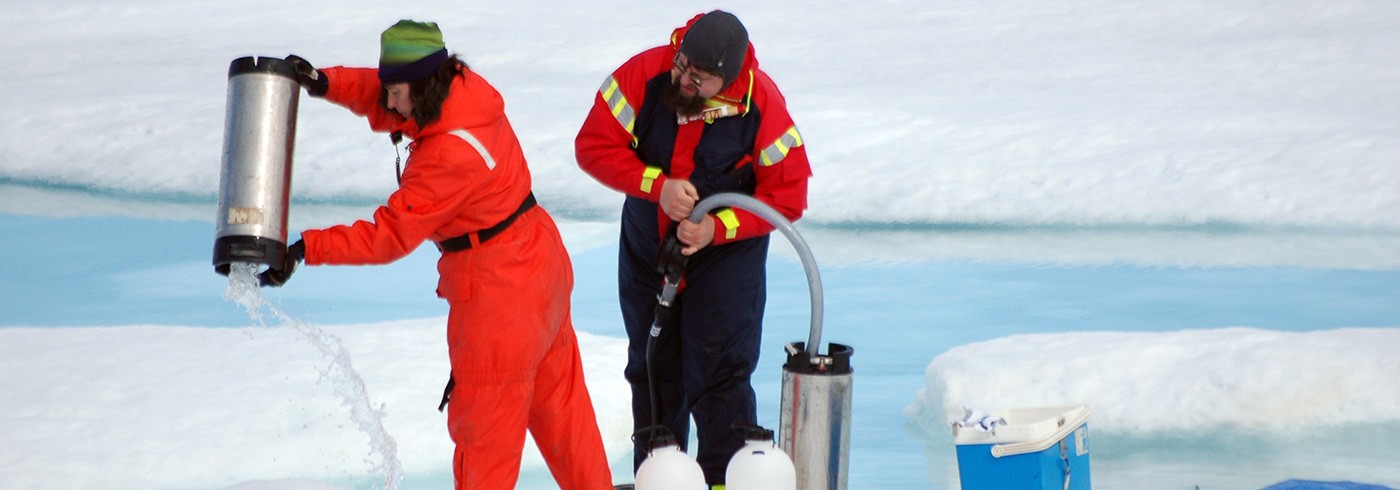
CO2 fluxes were measured using a closed path Li-Cor 6200 Infrared Gas Analyser. A clear plexiglass chamber was placed on top of the alloy chamber base marking each plot. Measurements were made under full sun, two shade treatments and complete darkness in order to generate a Light Use Efficiency (LUE) curve for each plot. Gross Ecosystem Exchange (GEE) was determined by subtracting the dark measurement (Ecosystem Respiration: ER) from each of the light measurements (Net Ecosystem Exchange: NEE). Following measurement of CO2 flux, headspace samples were extracted from the plexiglass chamber at set time intervals using a syringe and transferred into evacuated glass vials for laboratory analysis following the expedition. CH4 analysis was performed by Teh and Rhew at the Atmospheric Biochemistry Laboratory of UC Berkeley.
Hyperspectral Reflectance was recorded at each plot using a PP Systems UniSpec single channel spectral analysis system. This data was used to calculate a Normalized Difference Vegetation Index (NDVI), which is an index of vegetation greenness and commonly used in the arctic as a proxy for aboveground productivity and photosynthetic carbon uptake potential. NDVI calculations ((R800-R680)/(R800+R680) where R = Reflectancewavelength(nm)) are sensitive to the spectral properties of plant pigment absorption within the visible light range and reflectance in the near-infrared range. Aboveground plant biomass was harvested for all plots for post sampling sorting and analysis. Tundra monoliths measuring 25 × 25 × 25 cm were extracted from the first three sites visited. Monoliths were transported from the icebreaker Oden to Lund University where they are being maintained in growth chambers in preparation for a series of controlled experiments that will be conducted by Christensen. The experiment will also include monoliths collected recently by Christensen in Greenland and Scandinavia.
Preliminary results and discussion
Most correlations between temperature and CO2 flux showed little significance and are not reported here. Mean daily PAR was calculated for all sites and daily NEE was calculated using correlation indices derived from LUE models (not shown). This allows for normalizing of PAR for all sites and land cover types so that the carbon fixing potential of each land cover type at each site can be determined independently of prevailing light conditions and compared between sites. Dry and wet sites were the least and most productive land cover types at each location visited respectively (Table 1). Differences in the carbon fixing capacity of different land cover types illustrate the potential of land cover change to alter regional carbon balance. If there has been an expanse of dry tundra then it is likely that the carbon fixing potential of the region has reduced. Patterns in productivity are similar to those reported elsewhere in the Arctic. While wet sites show the greatest CO2 fixing potential, they were also the greatest sources of CH4 emission. Efflux of CH4 only occurred at plots with soil volumetric water contents above 80%. This could represent a threshold point at which tundra soils become anaerobic, permitting methanogenesis to occur. NDVI was most strongly correlated with ER, and showed weaker correlations with GEE and NEE.

Daily Net Ecosystem Exchange (NEE)(g/m2/ day) calculated using LUE models for each plot and mean daily PAR arbitrarily chosen for Site 1 (592). Positive numbers indicate carbon uptake.
Future work
The wealth of data collected from this trip has yet to be fully processed and analysed. Samples being sorted for above ground plant biomass estimates are almost complete. Analysis of soil peat samples are underway and will be completed by early 2006. Future data analysis will explore factors controlling carbon uptake storage and loss in dry moist and wet land cover types and multivariate models of carbon uptake potential will be developed. During summer 2006, high spatial resolution satellite imagery will be acquired for the sites visited and Land Cover Change assessments will be derived through intercomparison with historical declassified military imagery and archived aerial photographs. Deterministic models of carbon uptake potential will be run on the multitemporal land cover classifications in order to assess the probable impact of land cover change on ecosystem carbon fixing potential. The field component of the research conducted during the Swedish Beringia 2005 expedition will be repeated at multiple sites in Alaska during summer 2006. When combined with similar Land Cover Change assessments and modelling of carbon uptake potential as described above, we hope to be able to synthesize the likely impact of land cover change on ecosystem carbon balance at multiple sites throughout the Beringia region.
We are extremely indebted to the generous support, hospitality and collegiality of the Swedish Polar Research Secretariat and their staff who worked tirelessly to support the Beringia 2005 expedition.