Oceanographic investigations during leg 3 of the Beringia 2005 expedition
20 August 2005 - 25 September 2005
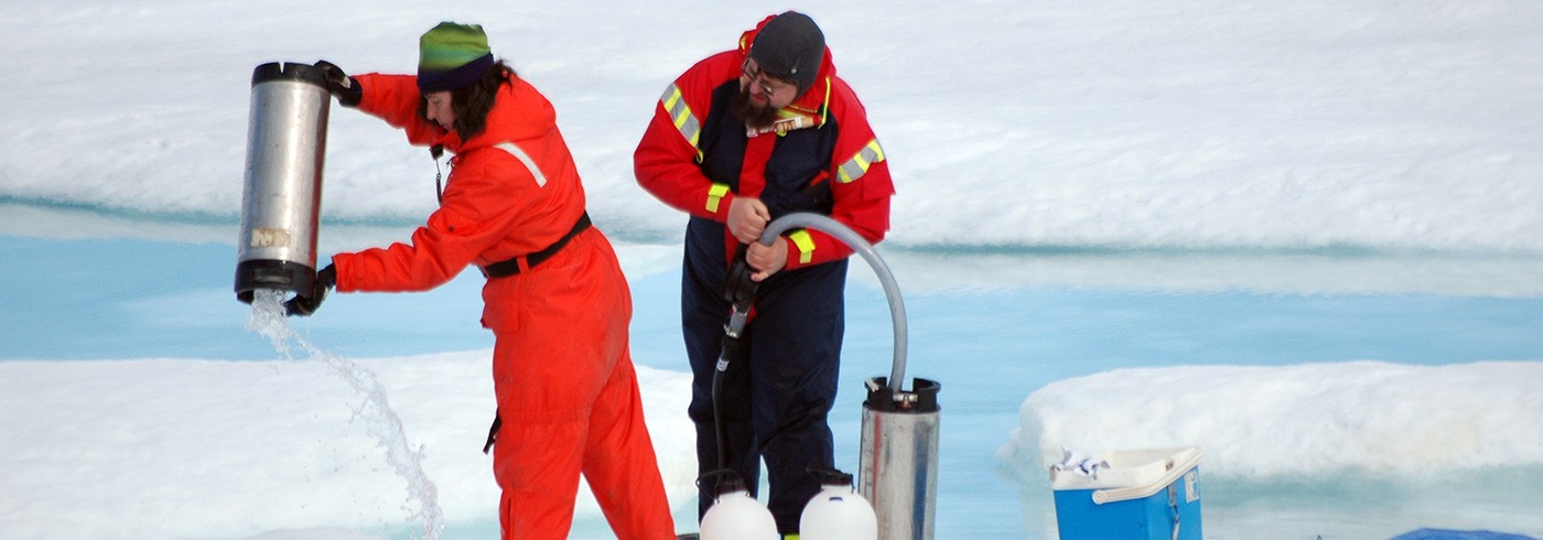
The 36-bottle rosette sampler is taken out of its container in preparation for the next cast. From the left: Jim Swift, Peter Winsor, Bert Rudels and Frank Zemlyak. Photo: Göran Björk
Objective
The overarching objective of the oceanography project during Beringia 2005 was to increase our knowledge of the role of the Arctic Ocean in the global climate system. An important part of the project was to study water masses with the aim of elucidating their circulation patterns, their formation areas and their role in transportation of heat and climate relevant chemical constituents. Added to this is the oceanic exchange with surrounding oceans, with a special focus on the Arctic Ocean’s role in the global thermohaline circulation.
Another aspect of the oceanic circulation, especially the transport of heat and salt, is its impact on ice formation and melting. During the last decades the sea ice summer coverage has decreased significantly, as has the mean thickness. An open question is if the cause is mainly atmospheric or oceanic forcing. The oceanography project aimed to add knowledge on the role of the ocean in affecting sea ice dynamics.
Much of the tracer work adds to the water mass investigation, but it also provides valuable information on ventilation of the subsurface waters. Hence the goal is to assess the magnitude of intermediate and deep water formation by utilizing the collected data in model computations of different levels of sophistication. Such studies will furthermore give estimates of the amount of anthropogenic carbon dioxide that the Arctic Ocean can sequester. Finally it is expected that the oceanographic data collected during leg 3 of the Beringia 2005 expedition will make up an unprecedented data set for the evaluation of the functioning of the Arctic Ocean in climate change, including the assessment of feedback mechanisms.
The fieldwork
Samples from 53 stations were collected for the oceanography project (figure 1), at up to 36 depths per station. During each cast the temperature and salinity were recorded by the CTD rosette. After the cast the rosette sampler was brought into a heated double container and samples where taken for a number of constituents. In the laboratories on board the following constitutions were determined; oxygen, nutrients (phosphate, silicate, nitrate and nitrite), total dissolved inorganic carbon (DIC), total alkalinity (TA), pH, halocarbon transient tracers (CFC-11, -12 and -113) as well as sulphur hexafluoride (SF6). Furthermore samples were collected for later determination of 129I as well as for the ratios of helium isotopes, tritium, oxygen isotopes and 14C.

Map of the Arctic Ocean with the oceanographic station locations noted.
Oxygen was determined using automatic Winkler titration; nutrients by standard colorimetric methods using an auto-analyser; the DIC by gas extraction and colorimetric detection; TA by potentiometric titration; pH by a spectroscopic multi-wavelength method; and CFCs as well as SF6 by gas-chromatography and electron capture detection. About 900 samples were collected to measure CFC-11, CFC-12, and CFC-113. This marked the first time that CFC concentrations were determined from the ocean surface to the ocean bottom across the central Canadian Basin, while full-depth measurements across the Amundsen Basin were able to provide repeat data to assess changes that have occurred there since 1991.
About 300 samples for the determination of 129I were collected and will be analyzed in France using an AMS mass spectrometry technique. For measurement of the ratios of helium isotopes, tritium, and oxygen isotopes 820 samples were taken, covering all hydrographic stations. Approximately 22 bottles were sampled at each station, with resolution focused in the stratified waters above about 1 500 meters, extending more sparsely to the bottom of each cast. The samples have been shipped to the Lamont-Doherty Earth Observatory for mass spectrometric analysis. 112 water samples were also drawn for measurement of 14C, which will be analysed at the NSFs NOSAMS mass spectrometry laboratory at Woods Hole. Samples were taken throughout the water column at 5 stations: two in the Canada Basin and one each in the Makarov, Amundsen and Nansen Basins. The14C results will yield estimates of the time since deep waters in these basins were last exposed to the surface. Tritium concentrations combined with helium isotope ratios and concentrations will yield similar estimates for shallower waters. Oxygen isotope ratios and tritium are both tracers for sources of the freshening of arctic surface and halocline waters.
Preliminary results
The upper waters of the Alaskan shelf and slope were very warm, suggesting local summer heating, the advection of warm Alaskan Coastal Current water and a convergence of warm surface water onto the slope. Pacific water was confined to the Canada Basin. It occupied a more than 200 m thick layer close to the slope, while further to the north, in the Beaufort Sea and beyond the Chukchi Cap, its thickness was close to, but less than, 200 m. At the Alpha-Mendeleyev Ridge its thickness was reduced to 150 m and Pacific water was practically absent in the Makarov Basin. The sub-surface temperature maximum of the Bering Strait summer water was located at 60–70 m and the temperature minimum of the upper, Pacific-derived halocline with a salinity close to 33.1, was identified around 150 m, except at the continental slope where it was located below 200 m. This upper Pacific-derived halocline water had nutrient maxima and oxygen minima as previously observed, which are believed to be formed by sediment interaction in the Chukchi-Bering Seas. Typically such conditions suggest low ventilation rates. However we note relatively high CFC values, indicating that ventilation is reasonably robust. The explanation may lie in the Chukchi shelf being a high productivity, moderately ventilated region in which oxygen is quickly consumed, but CFCs, which are biologically inert, are not.
The underlying Atlantic water revealed the warmer Barents Sea branch lower halocline at the continental slope and in the Beaufort Sea, while the colder Fram Strait branch halocline dominated between the Chukchi Cap and the Alpha-Mendeleyev Ridge (Rudels et al., 2004). In the Makarov and Amundsen basins only the Fram Strait branch halocline was encountered. The salinity of the Fram Strait branch halocline and the winter mixed layer over the Gakkel Ridge was around 34.0, less than the 34.3 encountered on the Arctic Ocean expeditions in 1991 on Oden, and in 1996 on the Polarstern (Rudels et al., 2004).
The temperature maximum of the Atlantic layer was slightly warmer at the continental slope than in the interior of the Beaufort Sea: 0.65°C as compared to 0.55°C. At the Chukchi Cap the Atlantic layer became warmer still, close to 1°C, and stayed that warm up to the Alpha-Mendeleyev Ridge where the coldest Atlantic layers, around and below 0.5°C, were encountered. The most obvious explanation for the observed temperature distribution in this layer is that the inflow of warmer Atlantic water first observed in 1990 (Quadfasel et al., 1991) now has reached the Beaufort Sea and replaced older and colder Atlantic water. The observations suggest that the boundary current partly separates from the slope at the Chukchi Cap and enters the deeper basin, while the rest follows the continental slope into the Beaufort Sea. There it enters the deep basin, perhaps as a broader front than at the Chukchi Cap. The colder Atlantic layer observed at the Alpha-Mendeleyev Ridge then implies that the displaced Atlantic water from the Beaufort Sea moves along the North American continental slope until it encounters the Alpha-Mendeleyev Ridge, where it re-enters the Canada Basin. This is one of the first observations of the closing of the gyre in the Canada Basin suggested by Rudels et al. (1994). Similar conclusions, based on oxygen observations, have been reached by Falkner et al. (2005). No similar indication of a closed gyre encompassing the Beaufort, corresponding to the outflow at the Chukchi Cap, could be seen. The temperature of the Atlantic core was almost the same in the northern Canada Basin, in the Makarov Basin and in much of the Amundsen Basin. In particular at the Lomonosov Ridge almost no temperature contrasts could be detected. This is different from the observations in 1991 from Oden (Anderson et al. 1994, Rudels et al., 1994) and in 1994 from Louis S. St. Laurent (Swift et al., 1997), when a clear temperature gradient was present across the ridge. This implies that the warm pulse that was observed in the Nansen Basin in 1991 and at the Lomonosov Ridge in 1994 now has passed along the Lomonosov Ridge, returning towards Fram Strait, while the warm pulse that was observed at the Siberian side of the Mendeleyev Ridge in 1993 (Carmack et al. 1995) has circulated around the Makarov Basin and now is partly returning from the North American side along the Lomonosov Ridge, completing a loop around the Makarov Basin. This recent warming of the Atlantic water in the Makarov Basin and cooling of the Atlantic water in the Amundsen Basin at the Lomonosov Ridge have also been reported by Kikuchi et al. (2005), based on observations from drifting ice-tethered buoys.
That a two-directional flow still is present at the ridge is supported by the less saline upper Polar Deep Water seen below the Atlantic layer on the Amundsen Basin side of the ridge, suggesting a recent input of less saline Barents Sea branch water (upper Polar Deep Water) entering at the St. Anna Trough and partly circulating along the Lomonosov Ridge. Low salinity upper Polar Deep Water was observed at the Siberian end of the Lomonosov Ridge in 1995 (Rudels et al., 2000).
The only sharp front in the Atlantic layer was observed in the central Amundsen Basin. As the Gakkel ridge was approached, the temperature and salinity of the Atlantic layer increased significantly. This indicates that a close recirculating loop brings recently entered Atlantic water back towards Fram Strait roughly along the Gakkel Ridge. Due to the ice conditions no stations could be occupied in the central Nansen Basin, but the final station taken at the continental slope north of Svalbard showed even higher temperatures and salinities. This agrees with the observations of warmer and stronger Atlantic inflow through Fram Strait in 2004 (Beszczynska-Möller, per. comm.), and with the warmer Atlantic water observed at the NABOS moorings north of the Laptev Sea in 2004 (Dmitrenko et al., 2005). This warm pulse has evidently not yet reached the central Lomonosov Ridge but a part of the warm inflow, which perhaps never reached as far into the Eurasian Basin as the NABOS moorings, has begun to return to Fram Strait along the Gakkel Ridge.
Compared with the 1994 Trans-Arctic Ocean section taken from the Canadian icebreaker Louis S. St. Laurent (Swift et al., 1997) the Canadian Basin has become warmer, while the Amundsen Basin and the Amundsen Basin side of the Lomonosov Ridge have become colder and the Gakkel Ridge again warmer. The high temperatures observed in the boundary current north of Svalbard suggest that further increase in the temperature of the return flows in the Nansen and Amundsen basins is to be expected in the near future. The effect of the warm pulses will later be seen in the Canadian Basin.
The CFC data strongly suggest that there is a significant flow of water entering the central basis north of the Mendeleyev Ridge from the better ventilated waters near the Eurasian coast. A similar less strong feature is seen west of the Chukchi Cap. The CFC concentrations were very low at the ocean bottom but were significantly above the detection level. This is consistent with an exchange time of the deepest water of a few hundred years.