Water mass transformations in the Arctic Mediterranean Sea and their implications for the ocean circulation

The sections taken on the Arctic Ocean 2002 expedition. The positions of stations shown in Figures 2 to 5 are indicated. East Greenland Current (EGC), West Spitsbergen Current (WSC), Irminger Current (IC).
Background
The climate of north-western Europe is anomalously warm compared to other areas at corresponding latitudes. This is due to the warm Atlantic water in the Arctic Mediterranean Sea that flows along the Norwegian coast and remains at the surface as far north as Svalbard. The Arctic Mediterranean Sea, comprising the Arctic Ocean, and the Greenland, Iceland and Norwegian (the Nordic) Seas, is the northernmost part of the Atlantic Ocean, extending from the Greenland-Scotland Ridge to Bering Strait, which makes a narrow, shallow connection to the Pacific. The heat loss in the Arctic Mediterranean cools the upper water masses, making them denser. They convect, forming intermediate and deep waters that recross the Greenland-Scotland Ridge and sink into the deep North Atlantic. These “overflow waters” renew the deep waters of the world ocean and cause a compensating northward flow of warm surface water across the Greenland-Scotland Ridge.
In addition to cooling, a second, contending, process controls the water mass transformations in the Arctic Mediterranean. The atmospheric transport of water vapour from lower to higher latitudes leads to net precipitation and to a large run-off from the surrounding continents to the Arctic Ocean. This creates a low salinity, less dense surface layer that prevents deep convection. The surface water becomes cooled to freezing temperature and sea ice is formed. This reduces the heat loss and further isolates the warmer water below, trapping its heat. The formation of overflow water is inhibited.
Ice formation extracts freshwater from the ocean, rejecting saline brine into the water column. On the shallow Arctic Ocean shelves offshore winds may constantly remove the ice from coasts and islands. The ice production becomes high, and brine accumulates at the bottom throughout the winter, increasing the salinity of the bottom water. This cold, highly saline water eventually sinks as dense, entraining plumes from the shelves down the continental slope into the deep basins, forming a second source of overflow water.
Presently about three quarters of the Atlantic water entering the Arctic Mediterranean is transformed into denser overflow waters (Hansen and Østerhus, 2000). The principal areas for formation of overflow water are the Norwegian Sea, the Arctic Ocean shelves and slopes and the central gyres in the Greenland and Iceland Seas, while low salinity polar surface water is mainly created in the Arctic Ocean. The major return flow of the transformed waters to the North Atlantic takes place in the East Greenland Current, which transports sea ice and polar surface water as well as denser waters from the Arctic Ocean through Fram Strait. In Fram Strait the East Greenland Current is augmented by the recirculating Atlantic water of the West Spitsbergen Current. Further south, Arctic intermediate water created by open ocean convection in the Greenland Sea is added to the East Greenland Current. Most of the East Greenland Current passes through Denmark Strait into the North Atlantic. Water too dense to cross the 620 m deep sill continues eastward north of Iceland and eventually passes south through the deeper Faeroe-Shetland Channel.
If a change towards a warmer and wetter climate should occur, as is predicted by several climate models (e.g. Manabe and Stouffer, 1993 and Rahmstorf, 1999), the cooling in the Arctic Mediterranean would become less severe and the salinity in the surface water would decrease. The formation of deep and intermediate waters would then be reduced and the Arctic Mediterranean would instead mainly produce less saline and less dense surface water. Model computations have shown that such change weakens the circulation, and less warm water is transported into the Arctic Mediterranean (Rahmstorf, 1999 and Rahmstorf and Ganopolski, 1999). This could in turn have an adverse effect on the mild climate of north-western Europe. To determine if such paradoxical situation − global warming leading to a colder north-western Europe – is possible, perhaps even probable, a better understanding of the oceanic transports and of the mixing processes and the water mass formation in the Arctic Mediterranean is needed.
Programme
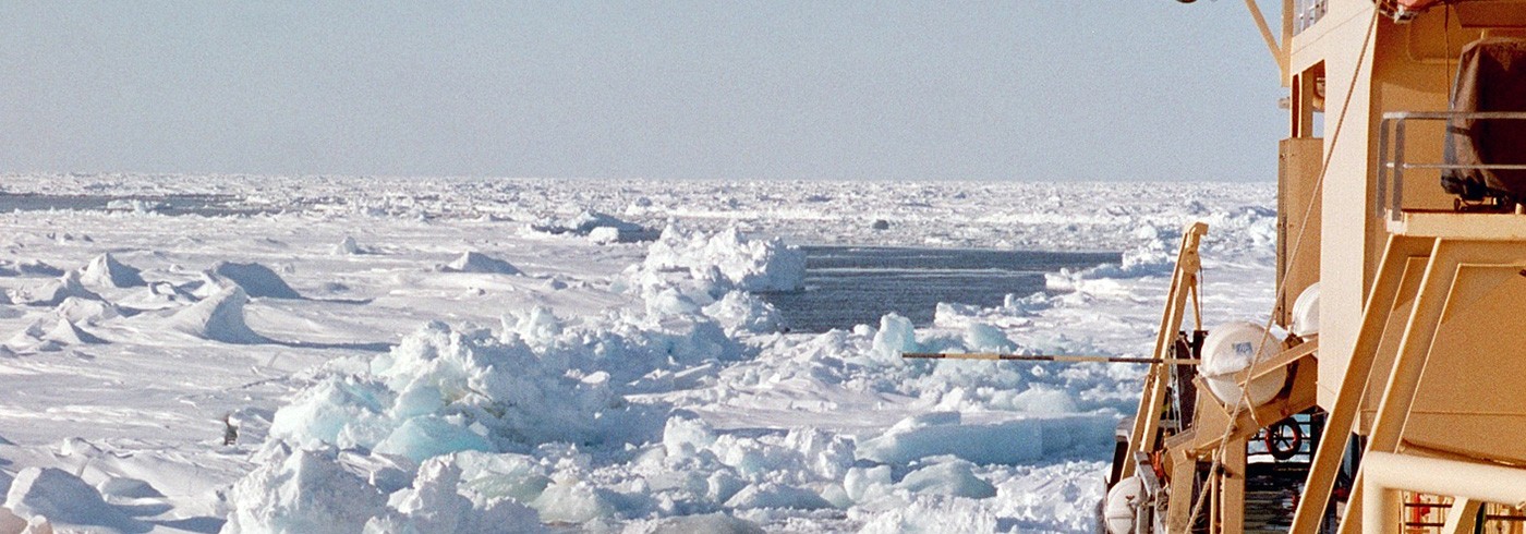
The Arctic Ocean 2002 oceanography programme was a two ship operation in cooperation with US scientists. RV Knorr of Woods Hole studied the inflow of Atlantic water and the open ocean convection in the ice-free part of the Nordic Seas, while the Swedish ice-breaker Oden operated in the ice covered East Greenland Current, taking hydrographic sections perpendicular to the current at different latitudes. Oden also worked in the ice covered area north of Fram Strait, observing the interactions between the northward flowing Atlantic water and sea ice during freezing conditions, and in the ice covered Storfjorden in the western Barents Sea, studying the formation of dense bottom water.
In the East Greenland Current the aim was primarily to study:
- The freshwater flux: In early spring the upper layers of the East Greenland Current are unaffected by the seasonal ice melt. The characteristics of the low salinity polar surface waters exiting the Arctic Ocean can then be determined, and it is possible to separate the freshwater flux from the Arctic Ocean into ice export and transport of liquid freshwater within the water column. A related question is the fate of the freshwater leaving the Arctic Ocean. Does it enter the central gyres of the Greenland and Iceland Sea, increasing the stability and adversely affecting the deep convection in these seas, or does it mainly continue south, exiting the Arctic Mediterranean?
- The evolution of the water masses in the East Greenland Current, through interaction with sea ice and by mixing and exchanging water masses with the interior of the Greenland and Iceland Seas, as the waters move south along the Greenland shelf and slope.
- The nature of the Denmark Strait overflow water: As the East Greenland Current continues south through Denmark Strait, the denser water masses contribute to the Denmark Strait overflow water. Which water masses are the most important, what are the changes in their characteristics, and how strong is the entrainment of ambient waters as the overflow plume sinks down into the Irminger Basin?
Observations
The physical oceanography observations consisted mainly of CTD (Conductivity, Temperature, Depth) measurements. The CTD (SeaBird 911+) was lowered from the stern, and vertical profiles of salinity and temperature were registered. In connection with the CTD casts, water samples for the chemical oceanography programme were taken using a SeaBird Carousel rosette sampler, and the current shear was measured by an Acoustic Doppler Current Profiler (ADCP) attached to the rosette sampler.
The conditions were often harsh. On the first station in Storfjorden the air temperature was below −10°C and water in the conductivity sensor froze on deck. The seawater was at the freezing point and being more saline, its temperature was below the freezing temperature of the water in the sensor. The ice did not melt. The conductivity sensor broke and had to be replaced. Further north the air temperatures were still lower (below −20°C) and the CTD had to be “watered” with warm sea water to prevent ice formation in the sensors when the CTD was transported on deck.
Oden was stopped several times because of heavy ice, and the ship often had to wait for the tidal currents to turn and the ice to loosen. In the open water the work was complicated by heavy sea, especially towards the end of the expedition. The western part of the northernmost section had to be moved southward because of difficult ice conditions, and one section in open water in the Iceland Sea was cancelled because of rough weather. Most of the planned section could nevertheless be taken and 100 CTD casts were made.
Preliminary results
The first 6 stations were taken along the axis of Storfjorden, a sill fjord located in the southern part of Svalbard. Oden became one of the few vessels that have entered Storfjorden in winter, when freezing and brine rejection are active. Storfjorden is known for its high ice production and high ice export (Haarpainter, 1999), and for the formation of cold brine enriched bottom water (Quadfasel et al., 1987). However, no high salinities have been reported during the last 10 years (Schauer and Fahrbach, 1999).

Potential temperature profiles (a) and salinity profiles (b) showing the effects of cooling, freshwater input and freezing on the water column. Dense saline water formed by brine rejection in Storfjorden (1), and flowing as a dense bottom current in Storfjordrenna (2), the less saline surface layer created by river runoff and the inflow of Pacific water in the Arctic Ocean (3), and the deep open ocean thermal convection in the Greenland Sea (4). 1db corresponds approximately to 1m, salinity (kg/1000kg).
Almost the entire water column was at freezing temperature, but the salinity increased from 34.75 in the upper 40 m deep mixed layer to a maximum of 35.83 at the bottom (165 m) (figure 2). These are about the highest bottom salinities reported from Storfjorden and are considerably higher than the 34.94 of the Eurasian Basin bottom water, presently the densest bottom water in the deep Arctic Mediterranean. The high salinity water could be followed as a 40 m thick bottom layer over the sill and into Storfjordrenna, a trough that leads to the continental slope west of Svalbard (figure 2).
The density of the bottom layer in Storfjordrenna was sufficiently high for itto sink down the slope into the deep and bottom waters of the Norwegian Sea, even when mixing with and entrainment of ambient water are taken into account. This is the process that operates on the shelves and slopes in the Arctic Ocean and leads to the renewal of the intermediate and deep waters of the Arctic Ocean (Nansen, 1906, Aagaard et al., 1985 and Rudels, 1986), ultimately contributing to the overflow water.
The eastern part of the northernmost section (2) extended from the shelf north of Svalbard across the Sofia Deep and over the eastern part of the Yermak Plateau. Two inflow branches deriving from the West Spitsbergen Current were observed. The inner branch was located over the continental slope north of Svalbard, the outer branch west and north of the Yermak Plateau. The Atlantic water formed a ∼600 m thick layer. It was, however, considerably colder and less saline than west of Svalbard and covered by a cold (freezing point), less saline, homogenous surface layer, 50 m thick north of Svalbard and over 100 m thick over the Yermak Plateau (figure 3). The origin of the low salinity upper layer in this part of the section is the melting of sea ice on top of the warm northward flowing Atlantic water. The Atlantic water is cooled, and the mixing of melt water into the water column transforms the upper part of the Atlantic water into a less saline, cold surface layer.

Potential temperature profiles (a) salinity profiles (b) west of Svalbard (1), from the inflow north of Svalbard (2) and north of the Yermak Plateau (3), and from the outflows from the Eurasian Basin (4) and from the Canadian Basin (5). The low salinity upper layer at the inflow stations is created by ice melt. The Atlantic water is colder and less saline while the intermediate water below is warmer on the outflow than at the inflow stations. 1db corresponds approximately to 1m, salinity (kg/1000kg).
Section 2 could not be continued westward as far north as planned, and its western part was shifted southward to run roughly along 81°30’N from west of the Yermak Plateau onto the Greenland continental shelf. The Atlantic water was here somewhat colder but significantly less saline than further to the east. This indicated the presence of Atlantic water transformed inside the Arctic Ocean and returning towards the Nordic Seas. The intermediate water below the Atlantic layer was, however, warmer than the intermediate water found at the inflow area, suggesting another water mass formed in the Arctic Ocean (figure 3).
The temperature of the low salinity upper layer was close to freezing, however the salinity was not constant as in the inflow area, but rather increased with depth. The thickness of the low salinity layer increased towards Greenland while the surface salinity decreased from above 34 to below 32. This implies that low salinity surface waters from the different basins are advected towards and converge north of Fram Strait. The least saline water, deriving from the Canadian Basin and from the Pacific Ocean, is concentrated to the Greenland shelf and slope, while the more saline polar surface water from the Eurasian Basin is located further to the east (figure 3).
Section 3 in Fram Strait extended along 79°N from the zero meridian onto the Greenland shelf. It showed that a significant part of the Atlantic water in the West Spitsbergen Current turned west and joined the East Greenland Current already in Fram Strait. It mixes isopycnally with the Atlantic water returning from the Arctic Ocean and its temperature is reduced. This core of Atlantic water could be followed as a temperature and salinity maximum on the sections further south as far as the sill in Denmark Strait, where it became a part of the overflow water.
Sections 4 and 5 were taken from the central Greenland Sea (75°N, 0°E) towards the shelf, 4 along 75°N, 5 towards south-west. Greenland Sea is known as a site for deep open ocean convection (Nansen, 1906). In the central part a thick, almost homogenous, water column with potential temperature −1°C and salinity 34.88 extended from the surface to about 1 600 m, indicating the depth of the winter convection in 2002 (figure 2). Arctic intermediate water from previous years could be seen in the East Greenland Current as far south as Denmark Strait and was also observed entering the Arctic Ocean north and west of the Yermak Plateau.
Section 6 and the northern part of section 7 in the Iceland Sea were located within the ice on the Greenland shelf. No significant ice melting had taken place and the low salinity polar surface water beneath the ice had characteristics similar to those on the sections further to the north. The winter mixed upper layer extended to 75–100 m, after which the salinity began to increase. The temperature, however, was close to freezing down to 200–300 m. No homogenisation of the water column down to the bottom thus occurs on the Greenland shelf during winter and no dense shelf water is formed. The cold (<0°C), low salinity surface layer was thicker further to the south than in Fram Strait, which suggests that the low salinity water was accumulated towards the inner part of the Greenland shelf (figure 4).

The difficult ice conditions prevented Oden from coming close enough to the Greenland coast to encounter the low salinity core of the polar water on all sections. The core was, however, observed often enough to conclude that it was not weakened by leakage into the gyres in the Greenland and Iceland Seas, but rather continued south through Denmark Strait. The thin, low salinity surface water observed in the central Greenland Sea also indicates that the influence of the polar surface water on the stratification in the Greenland Sea this year was small.
Section 8 at the sill in Denmark Strait and section 9 south of the sill showed the water masses contributing to the Denmark Strait overflow water. At the sill the temperature of densest water was −0.5°C and the salinity 34.88, suggesting a mixture of Arctic intermediate water from the Greenland Sea and perhaps also from the Iceland Sea, as well as intermediate water from the Arctic Ocean. Also the warmer recirculating Atlantic water was present at the sill and dense enough to contribute to the overflow. Above these waters the less saline polar water was mixing with the warm, saline Atlantic water of the Irminger Current, entering the eastern part of Denmark Strait from the south (figure 5).

Potential temperature profiles (a) and salinity profiles (b) from the sill in Denmark Strait (1, 2 and 3) and from the continental slope south of the sill (4, 5 and 6). The temperature maximum at the sill shows the recirculating Atlantic water. The colder, denser water is a mixture of intermediate waters from the Arctic Ocean and the Greenland Sea. South of the sill the low salinity upper part of the plume is conspicuous. 1db corresponds approximately to 1m, salinity (kg/1000kg).
South of the sill the overflow water was seen on the Greenland slope and in the deepest part of the Irminger Basin as a cold, dense bottom layer. The plume was stratified, and its upper part was less saline. This low salinity layer most likely derives from the less saline water above the Atlantic core in the East Greenland Current. The existence, and persistence, of such a “layer” from the sill down to almost 2500 m implies that the mixing and entrainment of ambient water into the denser part of the overflow plume must be small (figure 5). Much of the changes in characteristics of the overflow plume south of the sill can in fact be explained by mixing between the different overflow waters within the plume (Müller, 1979 and Rudels et al., 1999).
Dates
April–June 2002
Participants
Principal investigator and Co-ordinator
Bert Rudels
Finnish Institute of Marine Research
Helsinki, Finland
Principal investigator
Göran Björk
Department of Oceanography, Earth Science Centre, University of Gothenburg
Sweden
Principal investigator
Johan Nilsson
Department of Meteorology, Stockholm University
Sweden
Principal investigator
Daniel, J. Torres
Physical Oceanography, Woods Hole Oceanographic Institution
Massachusetts, USA
Principal investigator
Peter Winsor
Department of Oceanography, Earth Science Centre, University of Gothenburg
Sweden
Irene Lake
Department of Meteorology, Stockholm University
Sweden
Tim Newberger
Lamont-Doherty Earth Observatory of Columbia University
Palisades New York, USA
Christian Nohr
Department of Oceanography, Earth Science Centre, University of Gothenburg
Sweden
References
Aagaard, K., Swift, J.H. and Carmack, E.C. 1985. Thermohaline circulation in the Arctic Mediterranean Seas. Journal of Geophysical Research 90, 4833–4846.
Haarpainter, J. 1999. The Storfjorden polynya: ERS-2 SAR observations and overview. Polar Research 18, 175–182.
Hansen, B. and Østerhus, S. 2000. North Atlantic – Nordic Seas exchanges. Progress in Oceanography 45, 109–208.
Manabe, S. and Stouffer, R.J. 1993. Century scale effects of increased atmospheric CO2 on the ocean-atmosphere system. Nature 364, 215–218.
Müller, T.J. 1978. T-S characteristics and water masses during Overflow 73. ICES CM 1978/C:10.
Nansen, F. 1906. Northern Waters, Captain Roald Amundsen’s oceanographic observations in the Arctic Seas in 1901. Videnskab-Selskabets Skrifter 1. Matematisk-Naturvidenskabelig Klasse 1, 1–145.
Quadfasel, D., Rudels, B. and Kurz, K. 1988. Outflow of dense water from a Svalbard fjord into the Fram Strait. Deep-Sea Research A 35, 1143–1150.
Rahmstorf, S. 1999. Shifting Seas in the greenhouse? Nature 399, 523–524.
Rahmstorf, S. and Ganopolski, A. 1999. Long-term global warming scenarios computed with an efficient coupled climate model. Climate Change 43, 353–367.
Rudels, B. 1986. The Θ-S relations in the northern seas: Implications for the deep circulation. Polar Research 4 n.s., 133–159.
Rudels, B., Eriksson, P., Grönvall, H., Hietala, R. and Launiainen, J. 1999. Hydrographic Observations in Denmark Strait in Fall 1997, and their Implications for the Entrainment into the Overflow Plume. Geophysical Research Letters 26, 1325–1328.
Schauer, U. and Fahrbach, E. 1999. A dense bottom water plume in the western Barents Sea: downstream modification and interannual variability. Deep Sea Research I 46, 2095–2108.