Large scale albedo and sea ice concentration – determined from SAR data in the Arctic
Sea ice albedo is an important factor determining the overall energy balance of the ocean ice-atmosphere interface and the seasonal processes of sea ice growth and decay. Changes in sea ice albedo can affect regional and global climate through the existence of positive feedback loops (Budyko, 1969). The sensitivity of Arctic regions to various climate change scenarios is largely due to effects of the coupling between sea ice and surface albedo. The sea ice extent contributes to the large-scale surface albedo in the Arctic. Both sea ice extent and surface albedo are measured by satellite where sea ice extent derived from Synthetic Aperture Radar (SAR) data is a more easily accessible parameter under Arctic conditions than albedo measured by optical sensors. For monitoring in polar areas SAR, which is an active sensor, has the advantage of being able to measure under both cloudy and dark conditions. SAR data would give values of large-scale albedo distributions in time and space, determined from sea ice extent, and be an important tracer of climate variability.
Scientific objective
The scientific objective of the project is to contribute to the understanding of the albedo distribution in the Arctic, from direct measurements during the expedition as well as from future SAR data related to albedo distribution. In addition our data set can be of importance for ongoing model development in the international scientific community, not only for model evaluation but also to gain improved understanding of processes.
Field-work
The field-work carried out by SMHI can be divided into four parts:
- Albedo measurements for investigation of the relationship between albedo – SAR sea ice extent and radar backscatter coefficient.
- Illuminance measurements for verification of SAR sea ice extent.
- now measurements as complement to albedo measurements and for further investigation of weather dependency in SAR data.
- Deployment of an ice drifter in the Makarov Basin for the US Inter-agency Arctic Buoy Program (USIABP)
Albedo measurements
The broadband albedo of the sea ice was measured from the vessel along the route. The measurements were made continuously during the period 01.07.18 – 01.08.26 with only short interruptions due to small technical problems.
The instruments, four pyranometers measuring incoming and outgoing short-wave irradiance respectively, were fastened on bars on each side of the vessel. Each pyranometer measured over a quarter of a sphere in the outward direction from the ship, since they were protected with shields in order not to be influenced by the hull. The tilting of the ship was measured by an inclinometer as a quality check on the irradiance measurements. The instruments were logged to a GPS.
As a complement to and control of the albedo measurements recorded from the icebreaker, a portable construction equipped with two pyranometers was used in order to characterise different surfaces on the ice at certain locations along the ship track. Those pyranometers were not shielded and measured over a half sphere. The different surfaces were also characterised by measurements such as snow thickness, wetness, density and grain size.
The sea ice and snow albedo measurements will be used to determine the relationship between albedo and sea ice extent derived from SAR images. Algorithms to determine sea ice extent from SAR data have been developed in the Arctic (Dokken, 2000, Kwok, 1998). SAR data have been used to verify sea ice extent determined from Special Sensor Microwave Imager (SSM/I). Since the resolution of SSM/I is coarse and ice concentration derived from SSM/I data, particularly in the marginal ice zones, can be less accurate due to heat fluxes from melt ponds on the ice during summer time, SAR sea ice extent is more reliable (Dokken, 2000).
The relationship between albedo and the SAR backscatter coefficient, σº, will also be analysed. According to Thomas at al., 1998, the albedo is also coupled to the actual radar backscatter coefficient, σº, which expresses the averaged intensity of backscattered microwave energy per unit area received at the SAR-antenna. A relationship between σº and albedo has been shown during melt periods in the Arctic.
A part of the albedo measurements were carried out in connection to National Oceanic and Atmospheric Administration passages. The project team of the EUMETSAT Climate Monitoring Satellite Application Facility (CM-SAF) will use the ground truth albedo data to validate satellite-based algorithms such as cloud cover (cloud mask) and sea ice albedo determined from Advanced Very High Resolution Radiometer-data carried by the National Oceanic and Atmospheric Administration.
Illuminance measurements
A verification of sea ice concentration from SAR data by short-wave radiance measurements was also carried out. An illuminance meter measured the radiance of an undisturbed sector on the starboard of the ship. It recorded high or low radiance, corresponding to ice or no ice respectively. The instrument was logged to the same GPS system as the pyranometers onboard Oden in order to verify the ice concentration in certain positions in the SAR images. The same sector on the ice was also recorded by a video camera.
Snow measurements
Snow measurements such as thickness, wetness, temperature, density and grain size were carried out at the 35 ice stations along the expedition route. The snow thickness was measured every second metre along at least 100 meters at each ice station. The measurements will be used as a complement to the albedo measurements and will also be used for further investigation of weather dependency in SAR images (Lundin, 2001, Lundin, 2001).
At the ice drift station the snow parameters were measured along three 100-meter lines almost every day in order to study the time evolution of the snow cover. These will be compared to similar measurements from the Oden Arctic expedition 1996.
Ice buoy
An ice drifter, provided by US National Ice Centre, was deployed on an ice flow in the Makarov Basin for the US Inter-agency Arctic Buoy Program (USIABP). The ice buoy measures and transmits air temperature, air pressure and geographical position via the ARGOS satellite system. In return US National Ice Centre provided the expedition with OLS/Advanced Very High Resolution Radiometer, infrared and visible imagery and RADARSAT Scan SAR Wide data available along the track of Oden.
Preliminary results
All the measurements worked well during the whole expedition. Only some small problems with data logger program and the GPS antenna occurred but they were quickly solved with expertise onboard and did not lead to any significant data loss.
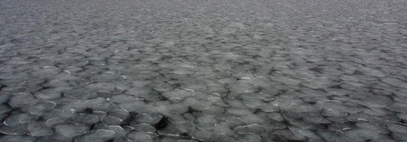
The broadband albedo is strongly dependent on level of cloudiness in the sky (Key et al., 2001). The reflection from snow is larger within the visible light interval than within the infrared wavelengths. Due to the absorption of infrared light within clouds the albedo decreases when the cloudiness decreases and the infrared light reaches the snow surface. The measurements were made with the unshielded pyranometers on a new snow surface at the drift station under 24 hours, 01.08.04 – 01.08.05.
Snow thickness and other snow parameters were measured at a total of 35 ice stations along the route. Between Svalbard and the North Pole (leg 2), 17 ice stations were carried out. The mean snow thickness of 50 measurements along 100 metre lines varies between 0.07 m and 0.37 m. The standard deviations along the lines were often large. The measurements were carried out between 01.07.18 – 01.07.30.
During the ice drift the snow thickness was measured along three 100 metre lines covering level ice and ridged ice respectively. The ridged area shows a thicker mean snow cover thickness and larger spatial and temporal variations than the level ice area which had a snow thickness of about 0.2 m during the whole ice drift period between 01.08.02 – 01.08.19.
Dates
18 July–26 August 2001
Participants
Principal investigator
Bertil Håkansson
Swedish Meteorological and Hydrological Institute, SMHI
Västra Frölunda, Sweden
Maria Lundin
Swedish Meteorological and Hydrological Institute, SMHI
Västra Frölunda, Sweden
References
Budyko, M.I (1969) The effect of solar radiation variations in the climate of the Earth. Tellus, 21, 611-619.
Dokken, S.T. 2000. Sea Ice Ocean Environmental Applications of Spaceborne SAR. PhD Thesis, Chalmers University of Technology, Technical Report No. 398, Dep. of Radio and Space Science, Gothenburg, Sweden.
Dokken, S., Håkansson, B. and J. Askne 2000. Inter comparison of Arctic sea ice distribution using Radarsat, ERS and SSM/I and in-situ data. Canadian Journal of Remote Sensing, 26 (6), 521 – 536.
Key,j.R., X Wang, J.C. Stoeve and C. Fowler. 2001. Estimating the cloudy-sky albedo of sea ice and snow from space. J of Gophysical Research, 106 (12), 489-12,497.
Kwok, R. (1998). The RADARSAT Geophysical Processor System. Analysis of SAR Data of the Polar Oceans, Springer.
Lundin, M. 2001. SAR Remote Sensing of Snow Covered Sea Ice in Brackish Water – Investigations from the Baltic Sea. Licenciate Thesis, Chalmers University of Technology, Technical Report No. 395L, Department of Radio and Space Science, Gothenburg, Sweden.
Lundin, M. and B. Håkansson. 2001. Temporal ERS SAR Analysis of sea Sea Ice Backscatter in Brackish Water – Baltic Sea. Submitted.
Thomas, A. and D.G. Barber. 1998. On the use of multi-year ice ERS-1 σº as a proxy indicator of melt period sea ice albedo. Int.J.Remote Sensing.19 (14), 2807-2821.