Deployment of a seismic recording station at Svea, Dronning Maud Land, Antarctica
20 December 2006 - 26 January 2007
Map of Dronning Maud Land showing existing and possible future seismographic stations.
Introduction
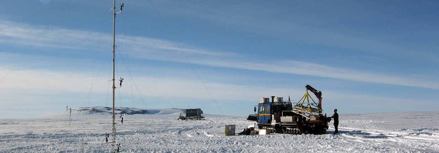
In December 2006, a seismic recording station was deployed at the Swedish research facility Svea in western Dronning Maud Land (DML). This project was established as part of our DROMNET. DROMNET is intended to establish a permanently operating large-scale regional seismographic network in Dronning Maud Land. Each station, whether permanently operating or operative during summer only, will be equipped with a modern seismographic broadband station (figure 1). These stations will form the permanent backbone of DROMNET while additional temporarily operating stations deployed at variable locations will complement the network.
The scientific background
The international network of seismic monitoring stations is still rather wide meshed in the whole of Antarctica. In greater Dronning Maud Land there are currently only 5 seismographic stations in operation at a selection of the permanently manned bases: Syowa (Japan), Novolazarevskaya (Russia), Maitri (India), Sanae IV (South Africa), Neumayer (Germany). This sparse station density constitutes a number of relatively severe limitations to seismological research in Dronning Maud Land. In particular, the monitoring of local and regional seismotectonic activities, and thus the investigation of geodynamic neo-tectonics in Dronning Maud Land, are considerably restricted by this handicap. Consequently, it is possible that the deployment of more seismograph stations in Dronning Maud Land will facilitate the mapping of the basic tectonic features, especially if evaluation of seismic data is combined with other geophysical data such as aeromagnetics and aerogravity.
DROMNET is intended to make possible the investigation of seismic activities and neotectonic processes in DML in more detail on a regional scale. Recordings from DROMNET may also be used to provide further information about the structure and physical properties of the Earth’s crust and upper mantle in different tectonic regions. This will lead to a better understanding of the tectonic evolution of this region. These results are of particular scientific importance as DML was the central region for the disintegration of the former supercontinent Gondwana. The scientific goals can be summarized as follows:
- A detailed mapping of the seismotectonic active areas may reveal the basic recent neotectonic processes in DML.
- The examination of source mechanisms may provide an insight into the relative movement of tectonic blocks and units.
- The analysis of the interconnection between postglacial lithospheric rebound due to deglaciation and seismicity along the continental margin will provide constraints for models of mantle viscosity.
- A detailed imaging of crustal and lithospheric structures in different tectonic units on a regional scale will become realizable by the deployment of additional temporary seismographic stations and the application of suitable seismological methods (receiver functions, inverse waveform modelling).
- Seismic tomography may become feasible and thus higher resolution models for the Earth’s deeper interior may be derived.
- The combination of models for lithospheric structures from seismological investigations with aeromagnetic and aerogravity measurements in DML will enable a comprehensive mapping of derived basic tectonic features on a regional scale.
- New insights can be achieved in the tectonic evolution of different tectonic units, especially in consideration of seismic anisotropy from shear-wave splitting analysis.

Example of regional event recording: A magnitude Mw = 6.2 earthquake with epicentre near the South Sandwich Islands recorded on 21 January 2007.
Implementation of the scientific equipment
On the morning of 27 December 2006, the equipment and personnel were carried by the aircraft Polar 2 (a Dornier 228-200 turboprop aircraft) via the Swedish station Wasa to Svea for installation of the seismic recording system.
Seismic station information
Geographic coordinates: 74°34.561’S, 11°13.508’W
Elevation: 1 259 m
Geology: Gneiss
Start of recording: 27 December 2006
Sensor: Lennartz LE-3D/20s
Data acquisition: Reftek DAS-130
Sample rate: 40 sps continuous
Data storage: 2 × 2 GB flash discs
Site description
A site just beneath the Svea hut was chosen as the best location for the seismometer (picture 1), since the flat surface provided by the exposed bedrock was particularly favourable for installation. The seismometer was sheltered with insulation foam and then completely covered by rocks as protection against heavy winds (picture 2). The insulation is intended to retain some of the seismometers internal heat dissipation and also reduce wind-induced noise. The Reftek DAS-130 recording station was installed inside the hut and connected to the hut’s solar charged power supply. The system’s GPS antenna for time-control was mounted on the roof of the hut and a cable entrance in the roof of the hut was used for GPS and seismometer cables. The cables were fixed to the roof and seismometer cable was buried by rocks.
In the late afternoon of 27 December 2006, the seismograph system was put into operation. Disk capacities and chosen recording parameters should allow a duration of operation of approximately 400 days. In case of power shortage, the Reftek system will shut itself down and start operation again when sufficient power is resumed.
On 16 November 2007, the aircraft Polar 5 visited Svea to download the recorded seismic data. Unfortunately, the acquisition system recorded successfully for a period of only 41 days. The acquisition stopped for unknown reasons on 5 February 2007, the ‘‘state of health’’-logs however having reported no problem until immediately before termination of data acquisition. Data acquisition has been started again but since we now expect hardware problems with the data acquisition system our aim is to exchange the system at the next possible visit. Figure 2 shows an example of a regional earthquake recording in January 2007. Nevertheless, despite the early interruption of data acquisition, a large number of earthquakes could be recorded including several events that can be used for studying the structure of the Earth’s crust and mantle.