Bathymetric data acquisition
31 July 2009 - 10 September 2009
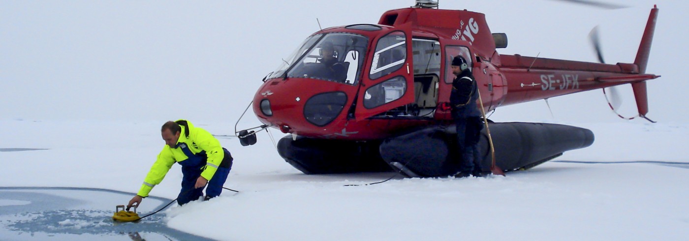
The Airmar 12 kHz transducer is lowered into a melt pond in order to make a bathymetric sounding. Photo: Henriette Skourup
Highest priority was given to the acquisition of bathymetric data. Oden is equipped with a permanently mounted Kongsberg multibeam echo sounder as well as a Kongsberg chirp sonar (sub bottom profiler). During LOMROG II Oden travelled a total of 3 402 nautical miles. Multibeam bathymetric data as well as sub bottom profiler data were recorded continuously along the ship’s passage.
Data quality is very dependent on the ice conditions. It is impossible to acquire high quality data during heavy ice-breaking and therefore alternative hydrographical surveying methods had to be employed in areas where high quality data was critical. During LOMROG I in 2007 the “pirouette method” was developed, where Oden would spin 360° in open water while sweeping the seabed with the multibeam.
The acquisition of high quality multibeam bathymetric data covering both f lanks of the Lomonosov Ridge was prioritised, enabling mapping of the foot of the continental slope (FOS) and the 2 500 m depth contour. This was achieved during 6 crossing of the Lomonosov Ridge with a distance of 10 to 55 nautical miles between profiles.

3D view of the area covered by new multibeam bathymetric data. The International Bathymetric Chart of the Arctic Ocean (IBCAO ) is shown as background.
The multibeam profiles on both flanks of the Lomonosov Ridge were supplemented by a total of 96 soundings from the sea ice along 11 profiles with a distance of 5 km between soundings. The profiles were positioned parallel to Oden’s track with a distance of approximately 15 nautical miles preferable on each side of the track and using the helicopter onboard Oden. A modified Reson Navisound echo sounder with an Airmar transducer was used (picture 1).

