The purpose of the project was to collect multibeam bathymetry and sub-bottom profile information along the western continental shelf of Greenland in order to characterize the shape of the seafloor and uppermost sediment properties. The main goal was to increase our understanding about potential pathways of relative warmer water influx towards Greenland’s many outlet glaciers. A program involving both seismic data aquistion, multibeam mapping, coring and seismic reflection profiling was conducted in order to study the past behaviour of the Petermann Glacier.
Scientific questions
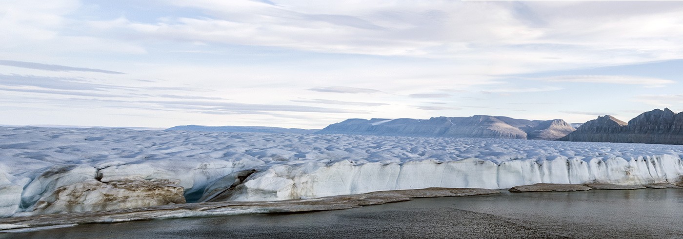
Petermann Glacier is connected to the inland ice through an ancient (perhaps pre-glacial) channel system, which extends from Petermann Fjord, deep into the inland ice along a pathway near the NEEM and NGRIP ice cores. This implies that the expedition with icebreaker Oden, targeting the longer-term marine history of the Petermann system, is constrained near its inland-ice source by well published deep ice-core data.
The expedition examined the relatively unexplored outlet end of this large system, by documenting changes in the grounded Petermann Glacier, its buttressing ice shelf, and ocean conditions since the end of the last glacial period. Primary scientific questions included:
- How sensitive is Petermann ice shelf extent to documented climate changes within the Holocene?
- Is ice-shelf response independent of, or linked to, variations in the grounded Petermann Glacier, ocean thermal conditions, or relative sea level (i.e., sill depth)?
- What are the rates of change and variability of these systems in response to early Holocene warming, Neoglacial cooling, and post-Neoglacial (late 19th century to present) warming?
Chief scientists
Alan Mix
College of Earth, Ocean, and Atmospheric Sciences, Oregon State University, USA
Martin Jakobsson
Department of Geological Sciences, Stockholm University
Swedish research projects
Towards an improved quantification of the Greenland meltwater discharges
The Greenland glaciers are currently experiencing large changes coincident with seaward surging of the Greenland Ice Sheet. A possible reason for the decline is warm salty deep ocean currents that accesses the floating glaciers as it intrudes at the bottom the Greenland fjords. Due to limited in-situ data, the magnitude and time scales of variability for the warm water intrusions are poorly known, as are its effects of the glacier discharge and meltwater production. The project is a pilot study in preparation for a later full-scale field project. The aim of this pilot project was to:
(i) Deploy five bottom landers in key positions along the Petermann fjord, setting them to pop up two every summer for five years thus providing data for the coming field program.
(ii) Perform extra hydrographic measurements and sections from small work boat if opportunity arises, by mini-CTD, MSS or XBT.
(iii) Perform opportunity-based hydrographic sections from CTD on board the Oden.
The obtained temperature time series from the bottom landers will be used to estimate the magnitude and time scales of temperature variability, and give a first inclination of the covariance between the warm water inflows and meteorological forcing.
Principal investigator
Anna Wåhlin
Department of Marine Sciences, University of Gothenburg
Development and testing of bottom-landers, LoTUS
Currently, there is a shortage of reliable measurements of oceanographic data from the seabed in the polar regions. The reasons for this are many, but the remoteness of the polar areas is naturally a significant hurdle. Cost and availability of suitable probes is another. An innovation project in collaboration between University of Gothenburg, KTH Royal Institute of Technology, and Stockholm University are developing technology and methodology for so called bottom-landers – the LoTUS system. These bottom-landing probes are to be deployed from boat or aircraft and sinks to the sea floor where registration of data is done for up to five years. After the prescribed measurement time, the probe releases the anchor and floats up to the surface where the data is transmitted to land using a satellite link. The innovation in the project is mainly focused on system robustness and cost effective methodologies which is reached through tailored design.
Bottom Lander for Long Term Underwater Sensing (LoTUS)
Deep sea probes face ultimate test in Arctic Ocean
Principal investigator
Jakob Kuttenkeuler
KTH Centre for Naval Architecture, KTH Royal Insitute of Technology
Trace gas biogeochemistry
The flux of the greenhouse gases carbon dioxide and methane from shallow oceanic sources to the atmosphere is an important part of the global carbon cycle. The researchers will make high accuracy continuous measurements of carbon dioxide and methane before and during the main expedition, including along the west coast of Greenland to the Nares Strait and Peterman Fjord.
This will allow characterization of the off-continent flow from boreal North America, and intercomparisions with the long-term high Arctic atmospheric monitoring stations at Alert, Canada and Summit, Greenland. The collected data will also expand the currently limited dataset of high-resolution in situ carbon dioxide and methane measurements in the near sea-surface atmosphere above shallow Arctic continental shelf areas. The data will be useful for inverse modelling of greenhouse gas dynamics in the climate sensitive Arctic.
Principal investigator
Patrick Crill
Department of Geological Sciences, Stockholm University
Arctic islands
The researchers in this project intend to clarify the potential consequences of global warming for terrestrial Arctic ecosystems.
More information about Arctic islands