MARA – Moveable Atmospheric Radar for Antarctica
1 January 2007 - 3 February 2007
Hans Nilsson and Ingemar Wolf at work setting up the MARA antenna field. Photo: Hans Nilsson.
MARA is an atmospheric radar which measures echoes from dusty plasma close to the summer mesopause (80–90 km heights), and from small-scale structures in the air in the troposphere and lowermost stratosphere (300 m – ca 12,000 m heights). The echoes can be used to measure wind profiles, to study the characteristics of the dusty plasma, and to study waves, turbulence and air-mass temperature gradients. Examples of the measurements are shown in figure 1 and 2.
The summer mesopause, at polar latitudes, is the coldest place in the Earth’s atmosphere, with temperatures of -150°C or lower. Even though the water content of the upper atmosphere is very low, such extremely low temperatures are enough to cause ice-clouds to form. The clouds, known as noctilucent clouds, can be seen from the ground when the sun is just below the horizon – they are then lit from underneath and the light, scattered at a low angle, picks out the many waves which cross the cloud layer. They are often observed from moderately high northern latitudes (~50°–60°N), which are high enough for the clouds to occur and low enough that the sun is below the horizon during the summer season. Noctilucent clouds are rarely seen from the ground in the southern hemisphere due to the lack of habitation at corresponding southern latitudes.
It is expected that changes in the amounts of carbon dioxide and methane in the atmosphere will lead to changes in noctilucent clouds. Increased methane is expected to lead to higher water vapour concentrations in the upper atmosphere, where methane is broken apart by ultraviolet radiation and the hydrogen released forms water vapour. At the same time, increased carbon dioxide concentrations will lead to increased radiative cooling of the upper atmosphere and potentially lower temperatures. Ground based observations of noctilucent clouds have not found any significant increase over the last 40 years (Kirkwood et al., 2003 and 2007, Dalin et al., 2006) while analysis of satellite data (DeLand et al., 2007) has suggested a significant increase. However, the satellite-based results depend on assumptions regarding the daily (tidal) variation of clouds, which are hard to test. Altogether it has become more and more apparent that noctilucent clouds are very sensitive not only to mean conditions but also to atmospheric waves and tides, and they provide a valuable tool to test our understanding of the atmospheric response to composition change in relation to those waves, as well as in mean terms.

MARA antenna field – the radar electronics is housed in the small module beside the antenna field. Photo: Hans Nilsson.
Atmospheric radars offer many advantages over visual observation for studying noctilucent clouds – they can observe regardless of tropospheric weather, they can observe all day round, they can be accurately calibrated, and they provide simultaneous and collocated information on winds and waves. They have been used for more than a decade at Arctic latitudes and the relationship between radar echoes (PMSE – polar mesosphere summer echoes) and noctilucent clouds is well established and fairly well understood. Far fewer observations have been made at Antarctic latitudes. The first attempts to observe PMSE in the Antarctic Peninsula were unsuccessful, and even though later attempts did detect some echoes, it was suggested that there is a large difference in mean conditions between the Arctic and Antarctica (Balsley et al., 1993, Woodman et al., 1999). Since 2003 a radar at the Australian Antarctic station Davis has regularly observed PMSE and qualitative comparisons have suggested that differences between the hemispheres were not so large (Morris et al., 2006 and 2007). Up to the end of 2006, however, no quantitative comparison between PMSE in the two hemispheres had been made, neither regarding mean conditions nor wave effects.
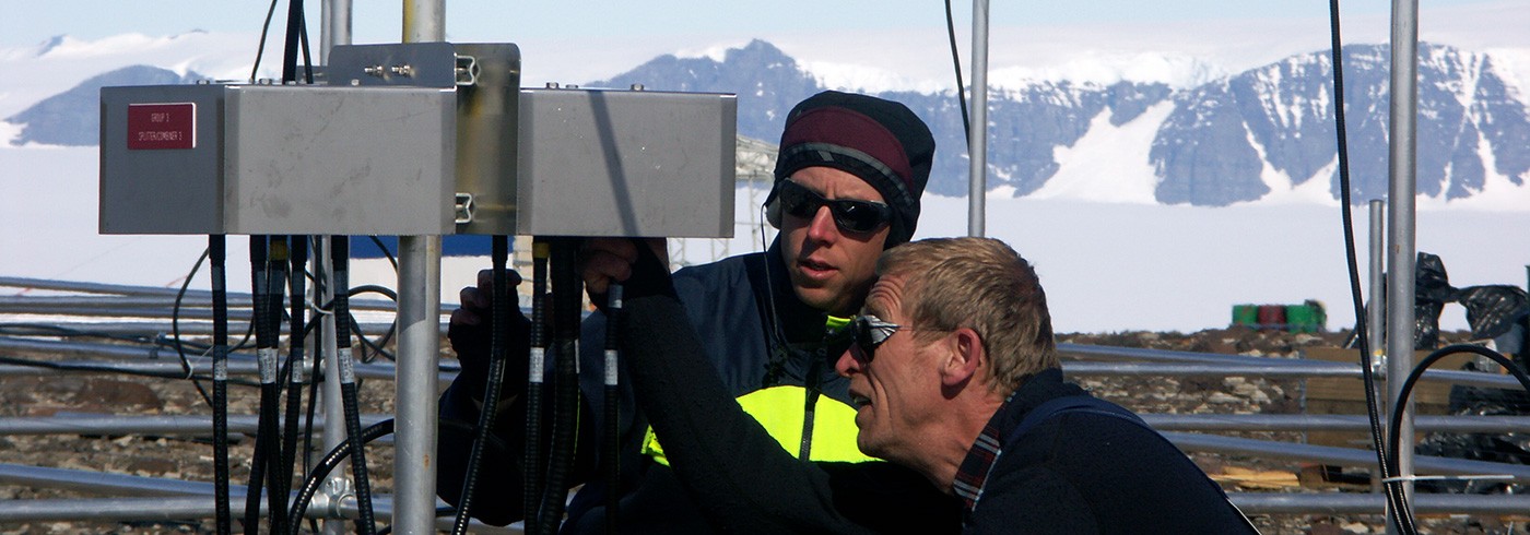
During August 2006, the MARA radar was set up to measure PMSE in Kiruna, Sweden (68°N, 21°E). This allowed an accurate crosscalibration with the ESRAD radar in Kiruna, which has been operating since 1996. After further technical testing in September, MARA was shipped to Antarctica where it reached Wasa at the end of December. On 7 January 2007, work was started to install MARA at Wasa. The radar consists of a control computer transmitter and receiver electronics, and a large antenna field (in fact, 3 adjacent fields each with a 4 × 4 array of dipole antennas). The antennas are supported on an aluminium framework, forming a grid with antennas centred above each cross-point in the grid, where there are also adjustable support legs down to the ground. A ground-plane of wire was stretched over the whole grid. Each square in the grid is 4 × 4 m and the antenna field stretches over 36 m in both N–S and E–W directions, all accurately aligned and levelled. The computer and electronics are housed in a small module adjacent to the antenna field and power was provided during the field campaign by a generator. Installation of the radar took 11 days and data was collected on 16 days between 18 January and 5 February. On 6 February the antennas and cables were demounted and stored in the container. The supporting framework was left in place to allow rapid start-up of operations next season.

Radar echoes from the dusty plasma at the mesopause (PMSE). The echoes are so strong that only 100 Watts of radar output power (average) were needed to take these measurements.
Echoes from the dusty plasma close to the mesosphere (PMSE) were detected which were as strong as the strongest seen in Kiruna, and the overall PMSE occurrence rates were about 30% higher at Wasa (figures 1 and 3). The results of this first accurately-calibrated cross-comparison have been published in Geophysical Research Letters in August (Kirkwood et al., 2007). Preliminary results from a cross-comparison with Davis (69°S, 78°E) show stronger and more frequent echoes at Wasa than at Davis (figure 2). This is in qualitative agreement with a recently published comparison between Davis and Andenes (69°N, 16°E) that found less PMSE at Davis than at Andenes (Latteck et al., 2007). The comparison between Davis and Wasa provides the first evidence that geographic, rather than geomagnetic, latitude is the most important influence on PMSE. (Davis is at a higher geomagnetic latitude than Wasa and it has been speculated that PMSE are most sensitive to energetic particle precipitation, which increases with geomagnetic rather than geographic latitude. In the Arctic, geomagnetic and geographic latitudes are almost the same, whereas in Antarctica, they are widely different due to the large offset between the geographic and geomagnetic poles).

Left: Measurements from the Antarctic troposphere between 24–31 January 2007. The upper panel shows echo strength, the middle panel wind speed and the lower
panel the level of turbulence in the air.
Right: Similar to the figure to the left, but for the Arctic troposphere, also in late summer.
Echoes from the troposphere (figure 2) show many features that are similar to those seen in Kiruna. The strength of the radar echo (upper panel) depends on humidity and (potential) temperature gradients. Easily discernable are the areas of increased power at an altitude of between 8–10 km corresponding to air immediately above the tropopause, which varies between 8 and 10 km in altitude. This is similar to the situation in Kiruna, except that the tropopause is sometimes very indistinct over Wasa. Wind speeds in the upper troposphere (middle panel) are relatively low, while winds in the lower troposphere are rather high. There is a period of higher wind strength at all heights on 28–30 January, which is also characterized by high levels of turbulence in the air (lowest panel). The wind is from a different direction (northeast) compared to the rest of the period (mostly southwest), and measurements of vertical wind (not shown) show strong waves in the lower troposphere at this point in time. It is probably that these are mountain waves caused by Basen (the mountain on which Wasa stands).

Comparison of PMSE occurrence rates at Kiruna (Sweden), Wasa and Davis (Antarctica). (Davis data courtesy of R. Morris, Australian Antarctic Division and R. Latteck, IAP Kuhlungsborn).