
Oden in front of Petermann Ice Shelf. Photo: Martin Jakobsson
An ice shelf is a floating glacier. Most ice shelves are formed as extensions of one or several ice streams that drain glaciers and large ice sheets by transporting ice to the ocean. The ice shelf begins from where the ice stream lifts from the bed and becomes afloat. The zone where this lifting occurs is called the grounding line, or more accurately, the grounding zone as it occurs over an area rather than one specific line. Seaward from the grounding line, the ice shelf typically thins until it becomes sufficiently fragile to break and form icebergs. This is called calving and the thinning is due to the mechanics of ice. Two main mechanisms can influence the ice shelf thickness:
- freezing underneath the ice shelf may occur which thickens it and,
- warmer water may interact with the ice shelf’s underside and instead accelerate the thinning substantially.
The latter is what has been found to happen with the Petermann Glacier ice shelf. Andreas Muenchow is a physical oceanographer from University of Delaware who has worked specifically with the oceanography of the Nares Strait, the body of water that separates Greenland and Canada. He has studied the interaction between warmer water of Atlantic origin and the Petermann Glacier. Over the last years, there has been a clear warming, although the series of existing oceanographic measurements are too short and do not provide sufficient spatial coverage to fully conclude what is happening. Therefore, Andreas’ main goal during our expedition is to collect CTD (Conductivity, Temperature, Depth) measurements along strategically placed transects in the Petermann Fjord area.

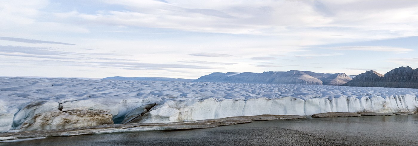
Oden in the middle of the Petermann Fjord. A part of the ice shelf that broke off August 2 is seen in the left of the photo. In the far back, the Petermann Ice Shelf is seen. Photo: Martin Jakobsson
The under-ice shelf environment is poorly known, in fact one of the least know ocean environments on Earth. We do not know much about the life underneath ice shelves nor the sedimentation that occurs there. We have now managed to completely map the seafloor in the Petermann Fjord with Oden in front of the ice shelf and cross over the sill, which is the shallow part that separates the outer Nares Strait from the inner deep Petermann Fjord. The seafloor morphology clearly reveals that the Petermann Glacier in the past extended all the way out and across the sill and flowed northward into Nares Strait. We also took several sediment cores in the fjord where there use to be an ice shelf. This means that we have captured the under-ice shelf environment as recorded by the accumulated sediments. Andreas collected a CTD transect from the sill to the shelf edge. We enjoyed ice free conditions in the fjord for a couple of days, then the wind changed and ice begun flowing back again. In fact, not too bad since we then could go out and concentrate on the sill which is critical for us to fully map and core. The part of the Petermann Ice Shelf that calved when we just arrived has now floated out towards the fjord sill. We steamed up just close to it several time, even if the ice shelf is rather thin at the front.

Mountains on the Canadian side of Nares Strait south of Hans Island. Photo: Martin Jakobsson
Our mammal observer Kate Lomac-MacNair has spotted many seals in the Petermann Fjord. She finds an interesting spatial pattern where the seals, specifically ring seals, hang out in front of the small outlet glaciers that drain ice from the surrounding high mountain glaciers along the sides of the fjord. In turn, this correlates with our sonar data showing plumes of sediments originating from sediment laden meltwater from these glaciers. Like on some many previous expeditions, it can be very productive to view scientific problems from many different disciplines, and an expedition is one of the absolute best places to bring scientist with different backgrounds together.

Left: Different locations of the Petermann Ice Shelf front. The bright green line from 2010-07-22 shows the extension of the ice shelf some weeks before the main break off event in mid-August. The purple circles show our sediment core locations and the black circles with green crosses oceanographic CTD-stations.
Right: The multibeam echo sounding mapping completed with Oden inside the Petermann Fjord. The data shows a suite of charactersistic landforms that will help us interpret the Petermann Glacier’s history. Illustration: Martin Jakobsson