
Oden vid Petermannfjorden. Foto: Martin Jakobsson
After passing the sea ice clogged passage at the southern end of Nares Strait, the transit to Petermann Fjord went quite fast. We had excellent support from the satellite images sent to us by the Polar Geospatial Center at the University of Minnesota. The transit was also facilitated by continuous sea ice reconnaissance flights with the helicopters. It became one of my duties to go with our Captain Mattias in the helicopter and place waypoints and record the flight tracks with my GPS. Back on the ship, I brought all GPS information into mapping software and made route plans. This process has to flow very fast; directly from the helicopter to the computer and make a map!
Along our way we dropped off barrels with fuel at two locations on the Greenland coast. The fuel was brought to land as sling loads hanging below the helicopter. Our pilots Sven and Johan have a lot of cold weather flying experience which is essential to fly in Arctic conditions. I met Sven for the first time 2004 when he was the helicopter pilot during the Arctic Coring Expedition (ACEX) in the central Arctic Ocean. Since he has been on numerous Arctic expeditions, I suspect that only few in the world have the same high Arctic flying experience as Sven.
When arrived to the entrance to Petermann Fjord August 3 it was blocked by sea ice, a new ice breaking challenge for Mattias and his crew and more helicopter flights. The southerly wind that prevailed for many days had pushed sea ice up against Hall Land in the north. Once we reached the location where the sea ice was pushed together, we decided to begin by mapping just south of it as it belongs to our main research area.
The scenery was simply spectacular. The high nearly vertical mountain walls along the fjord sides are dramatic to say the least.

Forskare från British Antarctic Survey (BAS) satte upp sitt basläger på shelfen. Photo: Markus Karasti
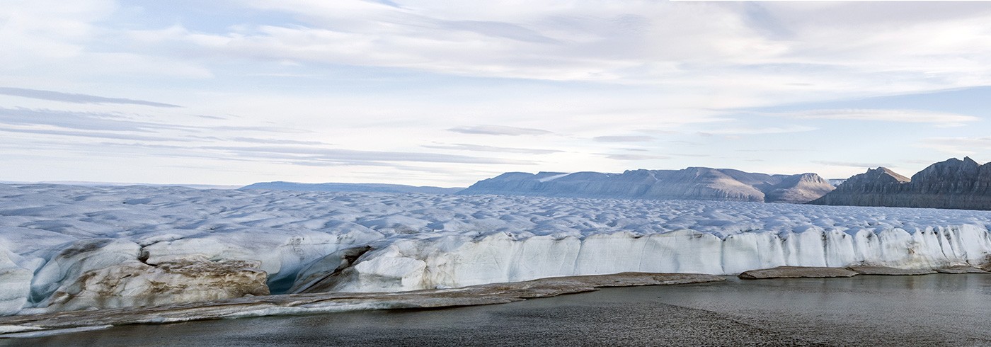
It was some work to break through the sea ice at the fjord entrance, but well inside, the area in front of the Petermann Ice Shelf was completely clear. Finally, we could begin map our main target area! This area was before the two big calving events 2010 and 2012 covered by the Petermann Ice Shelf. It means that we have a unique opportunity to map and take sediment cores in an area that use to be underneath an ice shelf. We are the first to be able to do this in the Petermann Fjord. One of our main goals with the entire expedition is to study the environment underneath an ice shelf. In particular since the Petermann Ice Shelf has thinned over the last decade. To complement our marine work, we have a team that will drill through the Petermann Ice Shelf from British Antarctic Survey (BAS). Next challenge is to fly them to their drill sites on the glacier including their drilling equipment which amounts to more than 13 tons!
Just when we entered the fjord, new reports came in that a rather large piece of the ice shelf calved. This was clearly seen on satellite images. The section that broke off was a bit wider than 3 km, so tiny in comparison to the previous calving events 2010 and 2012.